
UPDATE – Added Photos of Stream culvert, small marsh and Dry/Owatchet Creek
I went back to the area on July 21 to investigate where the stream actually flowed. You can see it in the Photo Record.
Original Post
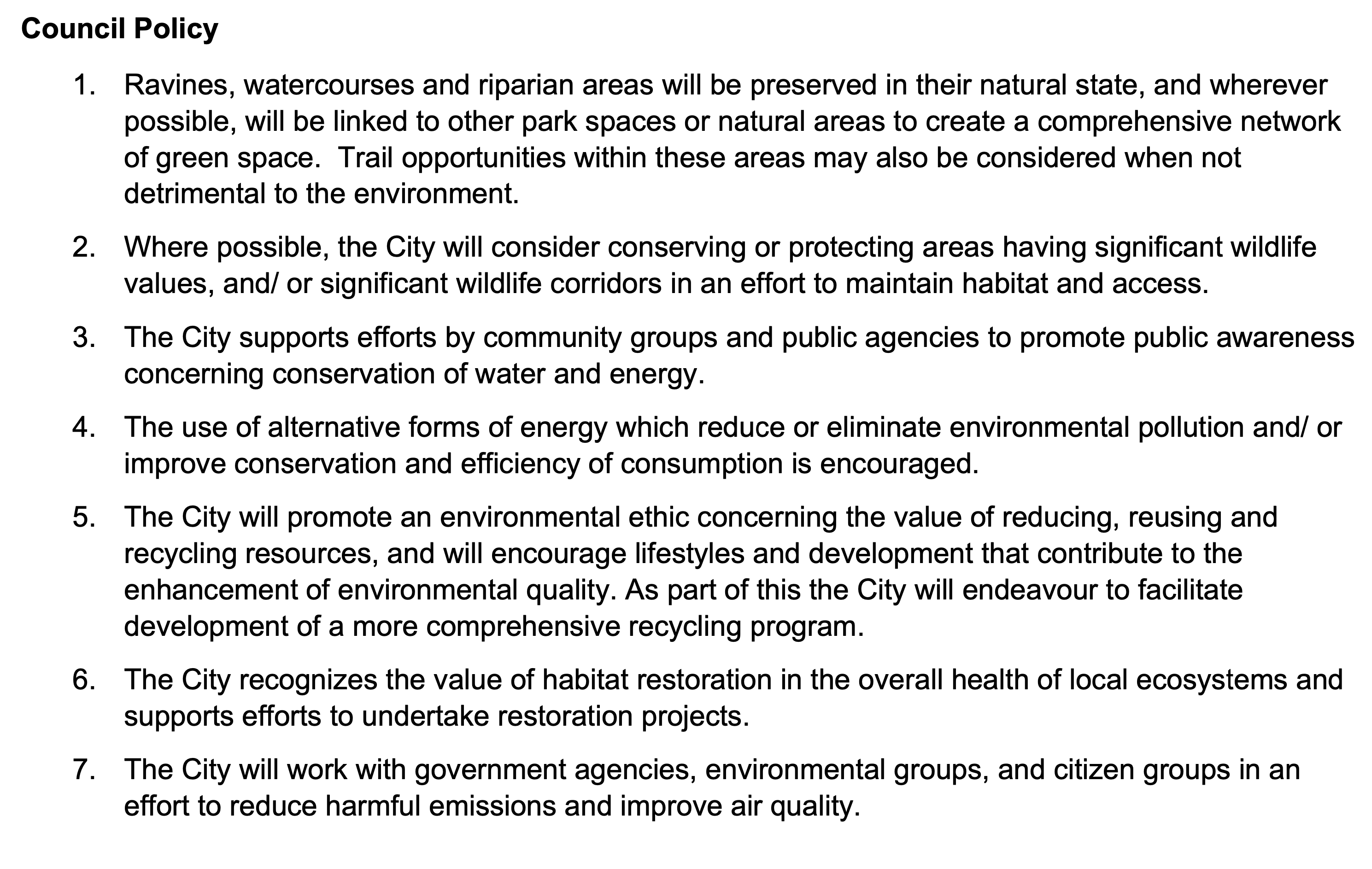
Council policy #1 under Environmental Policy in the OCP (page 23) says (emphasis added), “Ravines, watercourses and riparian areas will be preserved in their natural state“. The development of the Montrose and 15th area will impact a stream that runs along the back of the proposed subdivision. This stream is a significant tributary to Owatchet / Dry Creek. The following post deals with the environmental considerations of this development.
This post is a continuation of my post on the City of Port Alberni announcement of RFPs for Montrose and 15th and 11th Avenue Park.
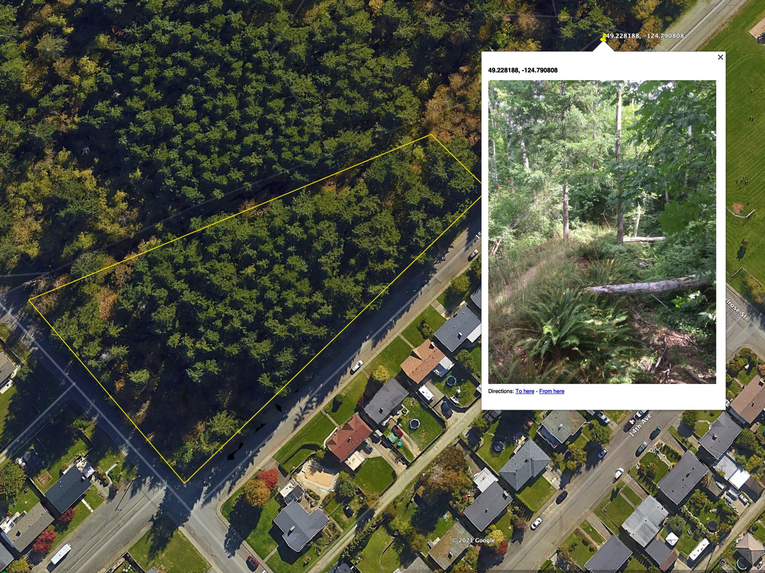
Photo record of the trail and stream.
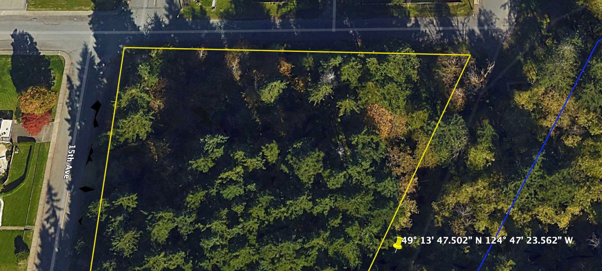
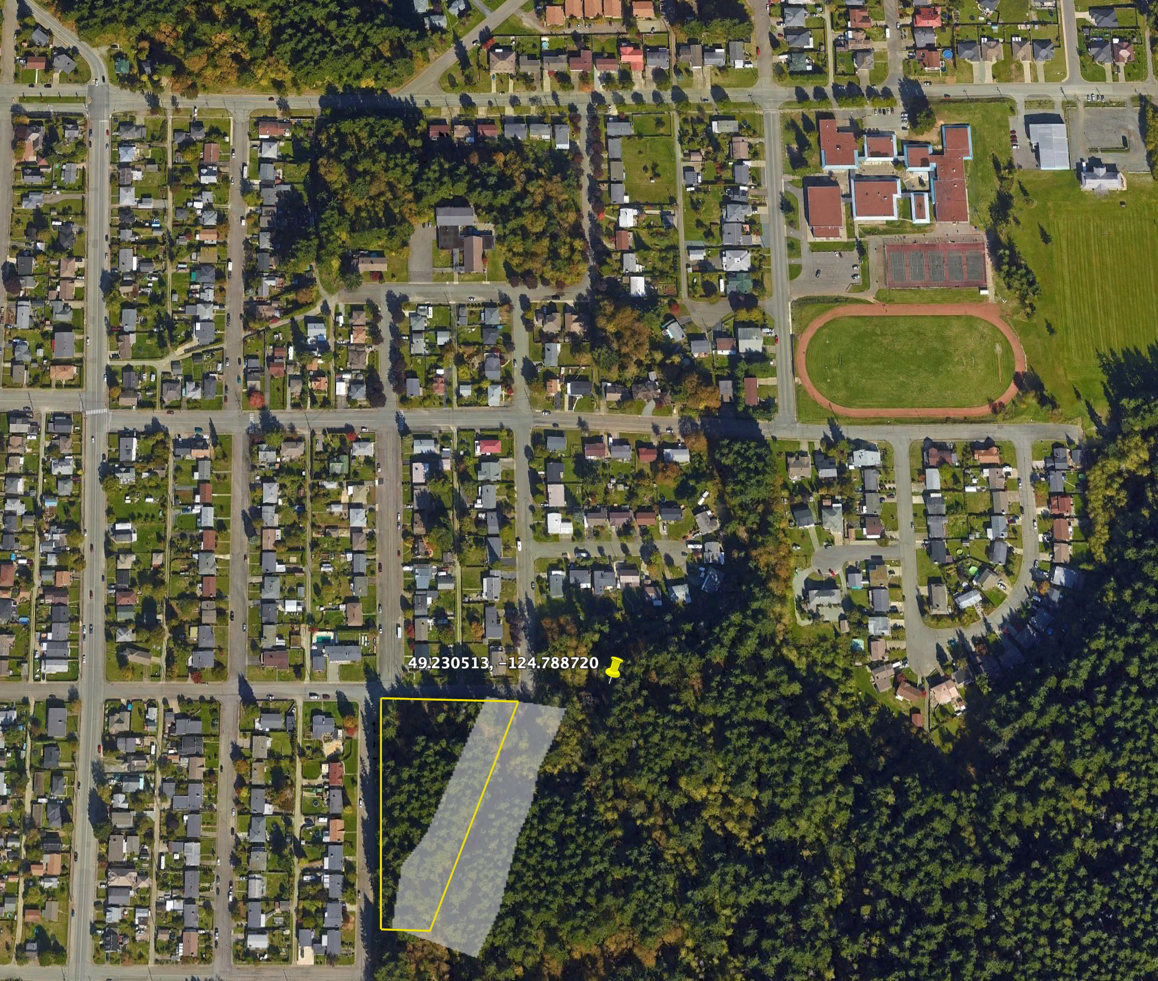
The trail and stream bank form the eastern diagonal boundary of the proposed development. This means it is possible that there could be properties right up to the edge of the stream, eliminating all the forest area between the stream and houses.
First, a photo record:

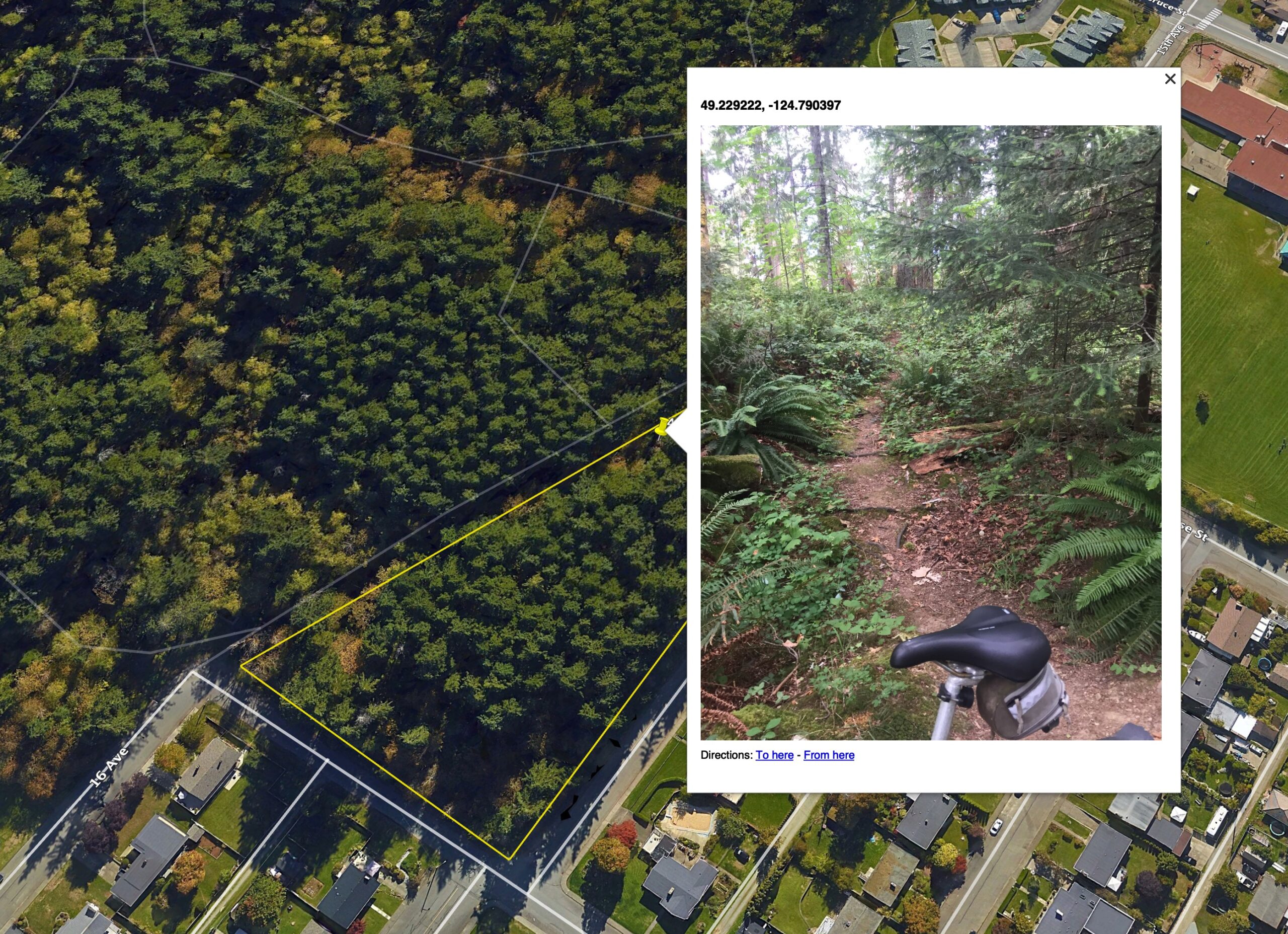
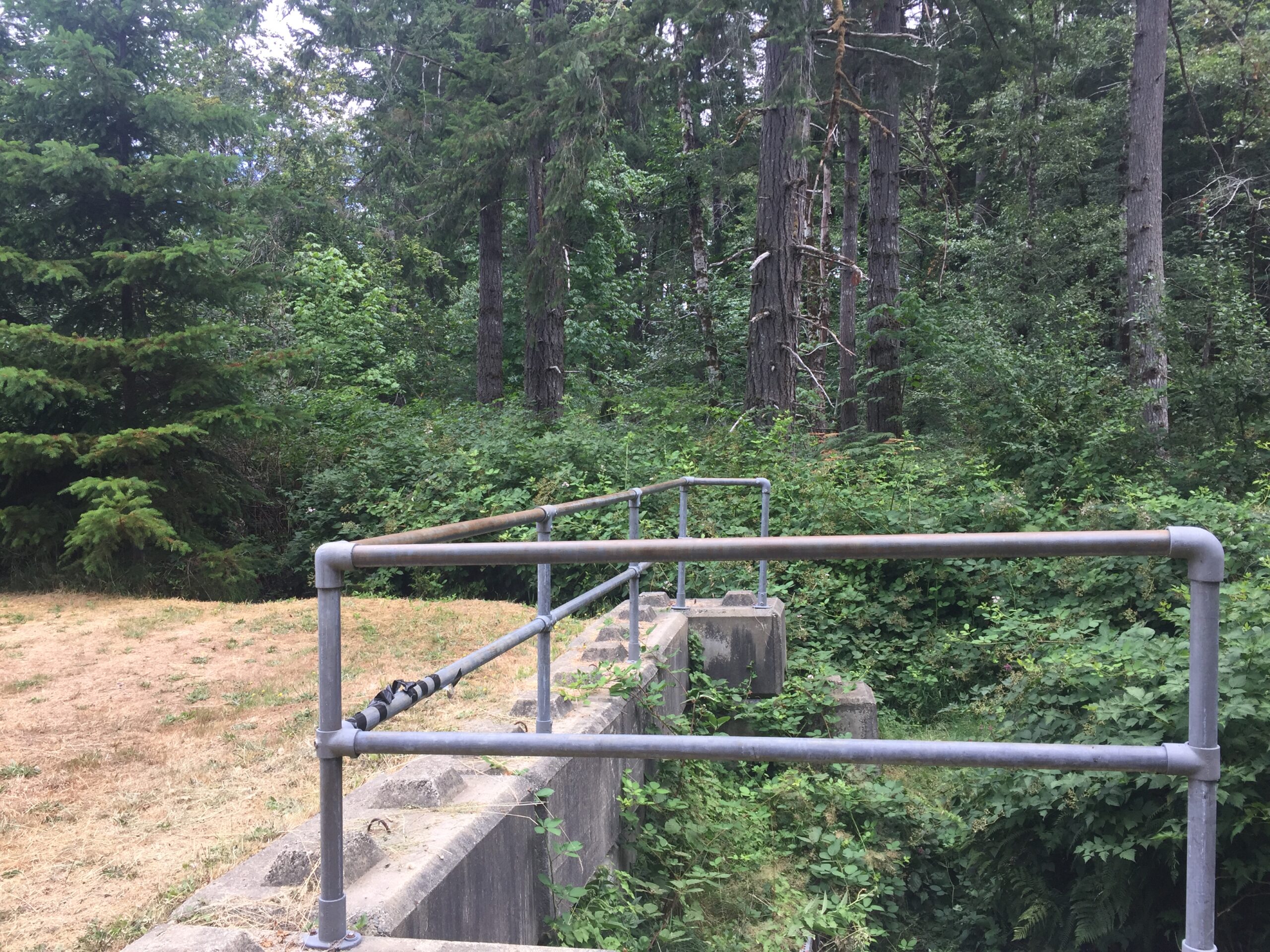
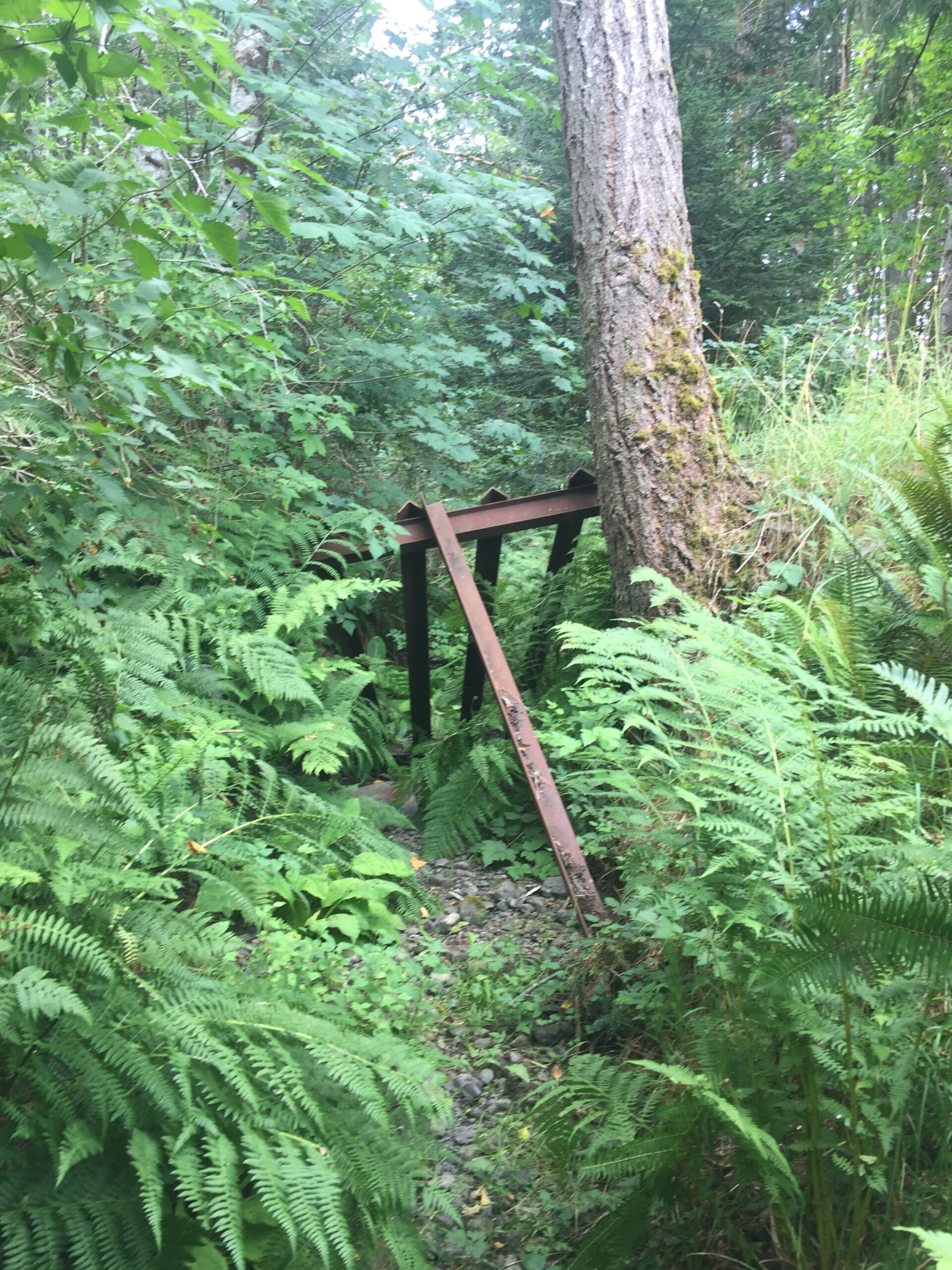
The entrance to the trail at the end of Montrose. The creek bed runs under the railings you see in the picture from right to left toward Owatchet / Dry Creek.
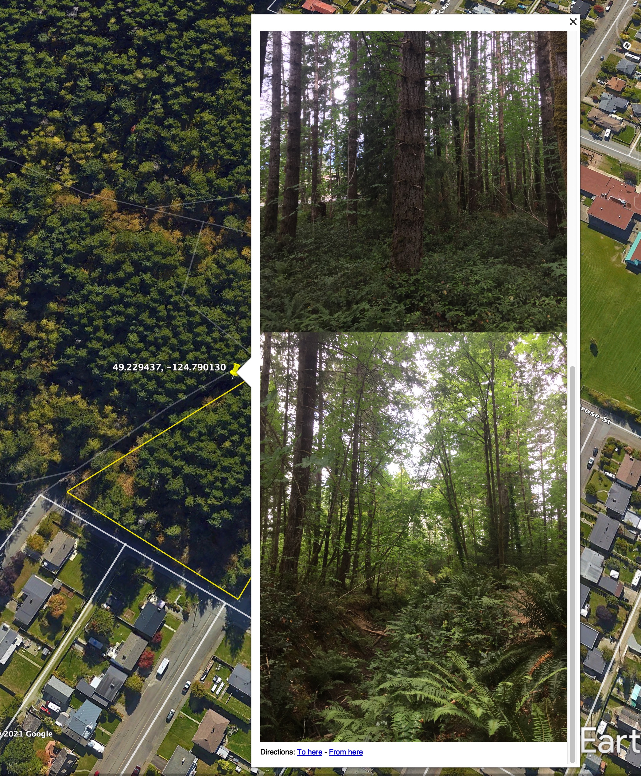
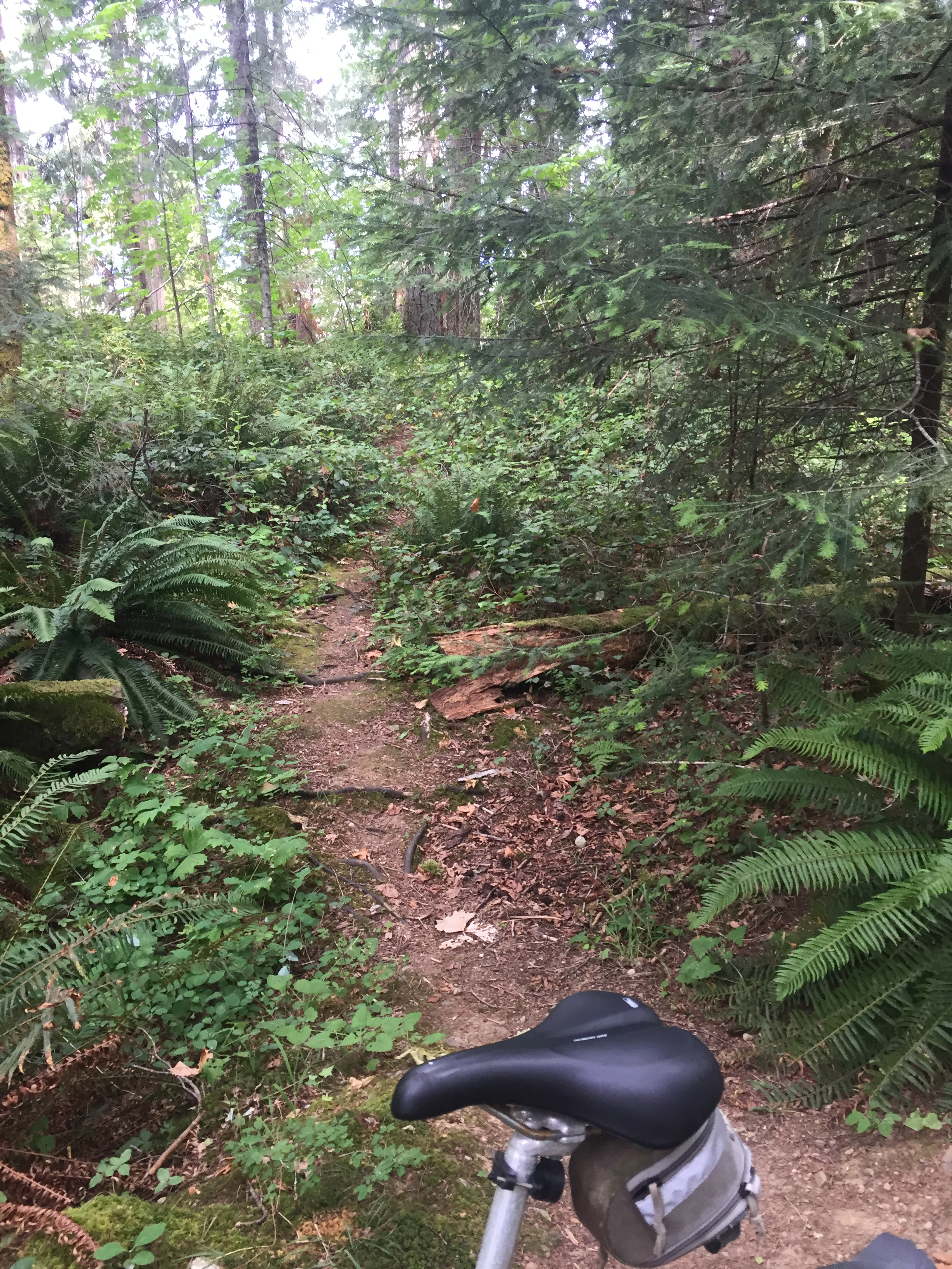
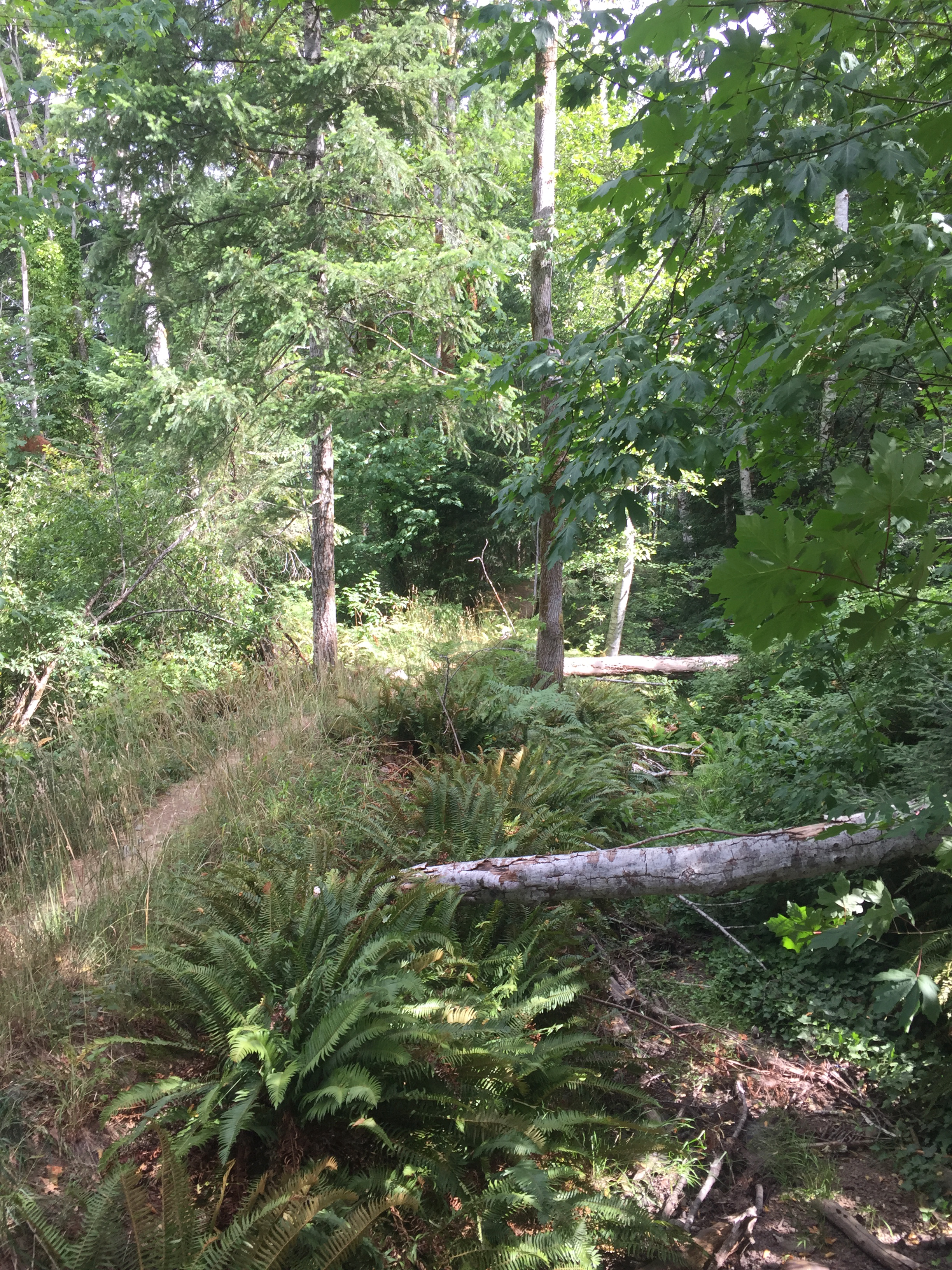
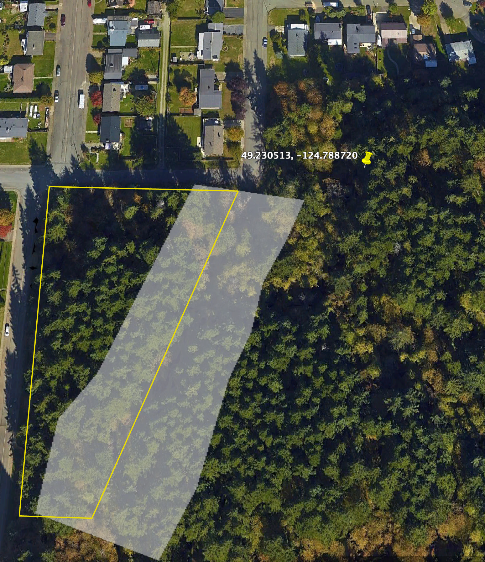
Next, the picture below is of the creek bed itself and trail which runs along the top of the west bank of the creek. This is at the end of the more open sky part of the trail (the pin in the map below), with deciduous trees, salmon berry bushes, and ferns. You can see there is significant undergrowth alongside and even within the creek bed.
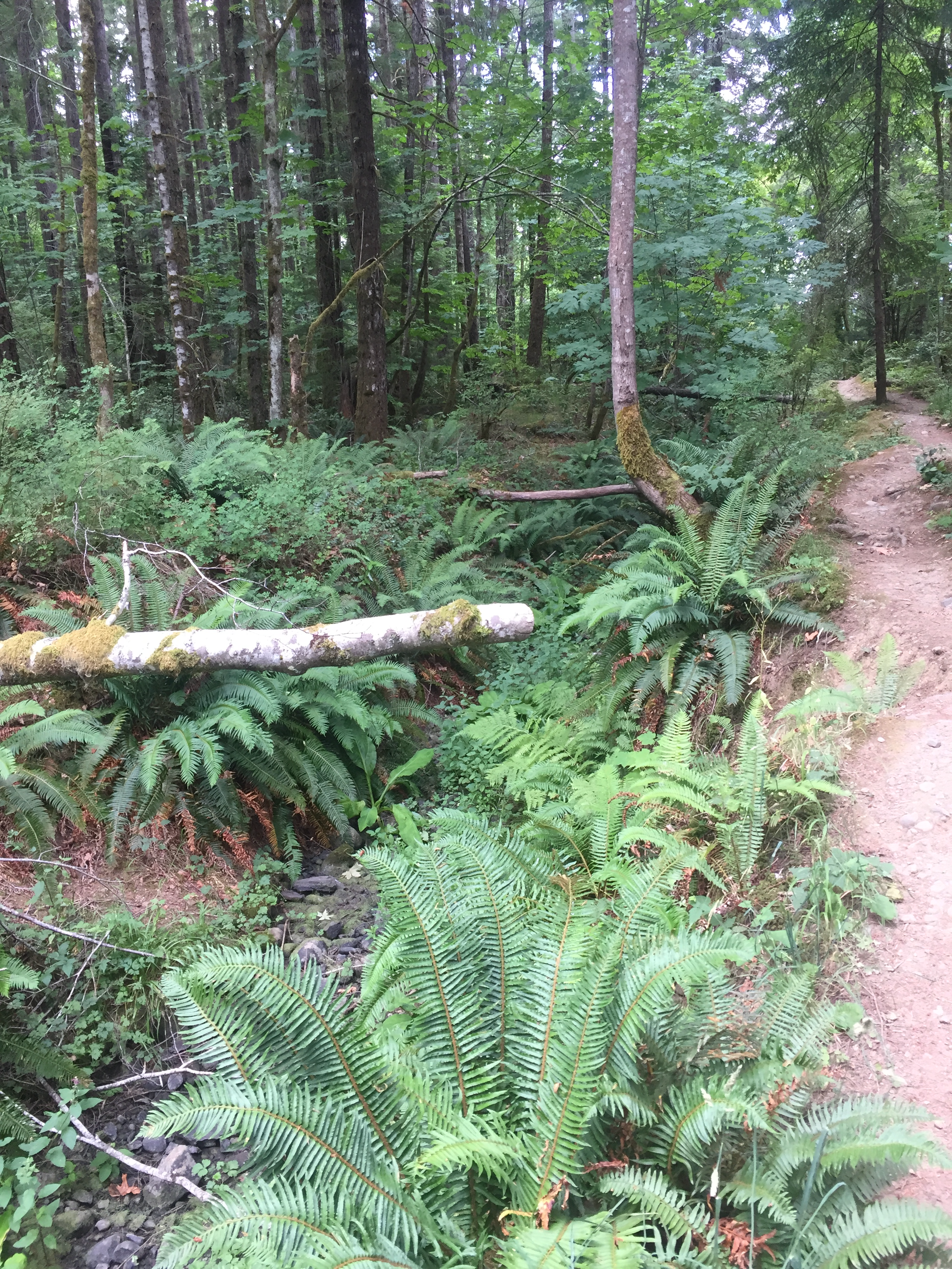
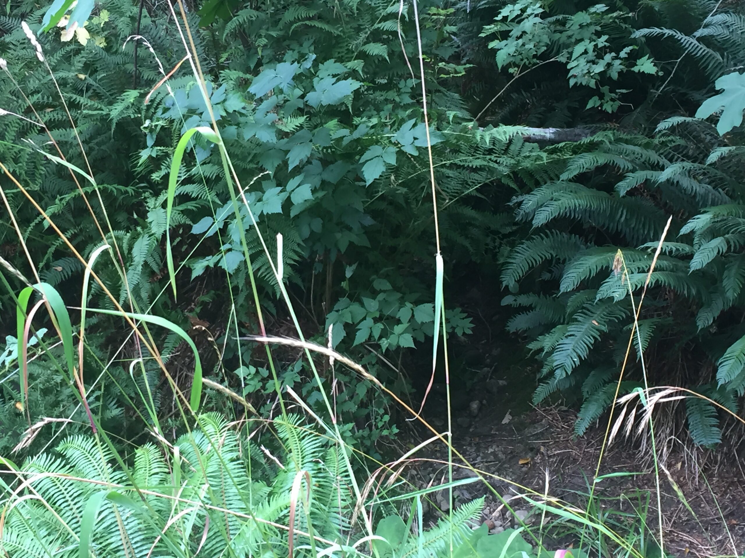
Next a look a little deeper into the trail, near the centre of the proposed boundary, and looking along the development property line through the trees.

Below is the creek bed near the same location, as well as a look back toward 15th Avenue through the stand of mature 2nd growth Douglas fir which would be eliminated by the development. Very shady and pleasant.
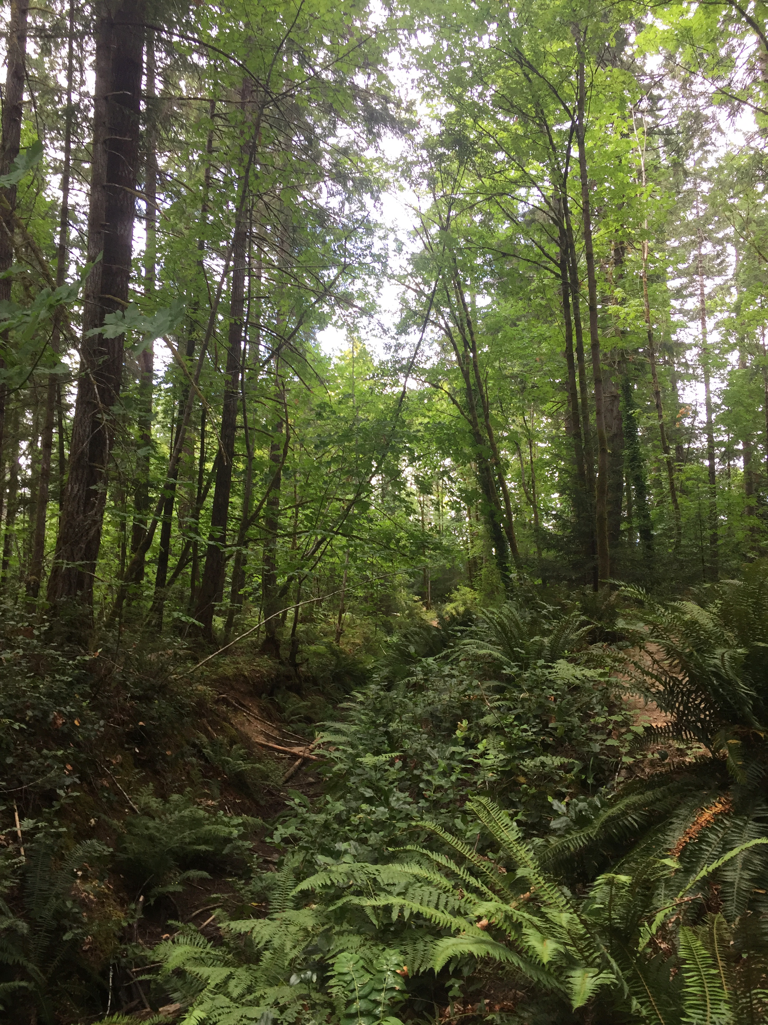

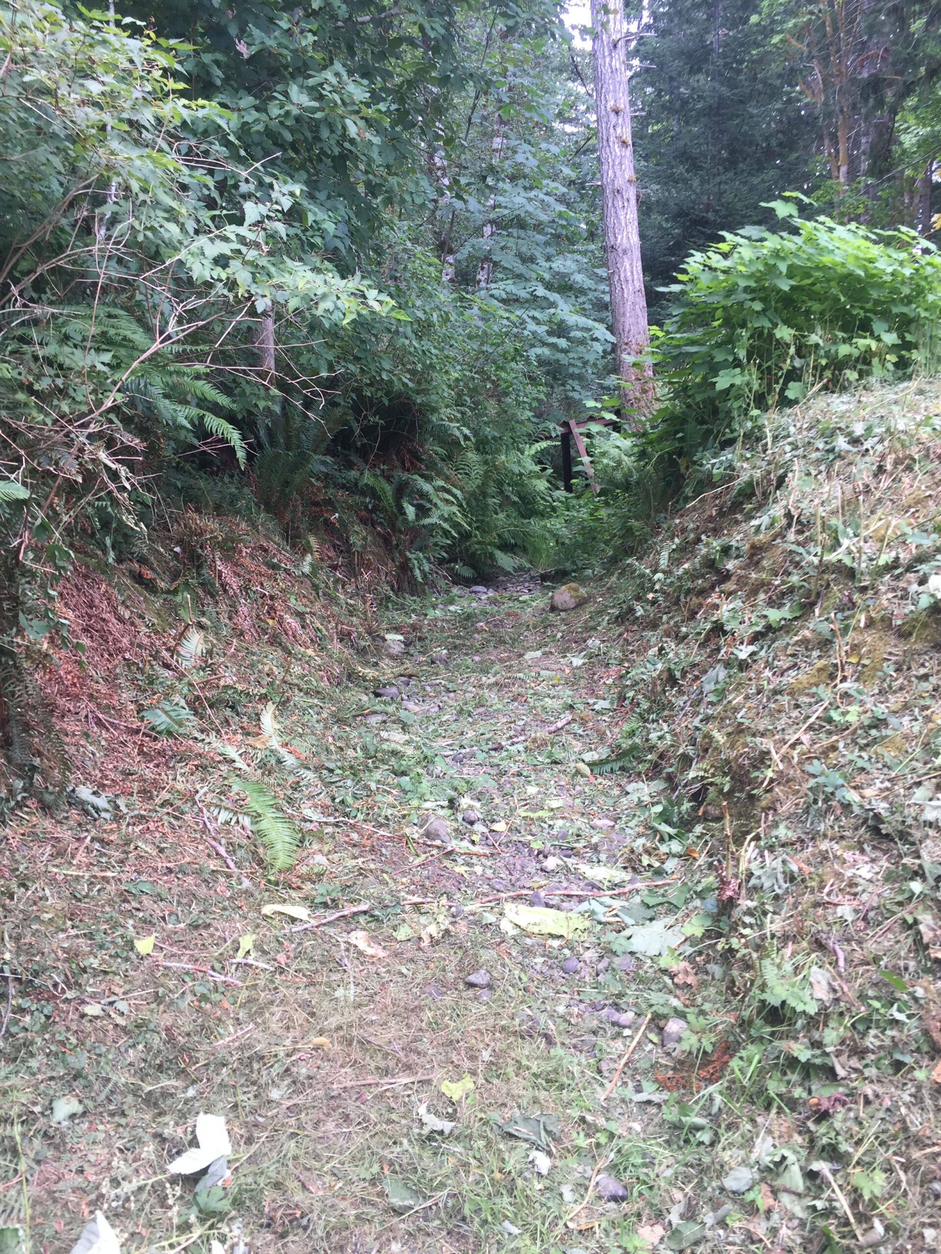
Here is a 3rd trail that goes toward 15th Avenue near the north end of the proposed development area.
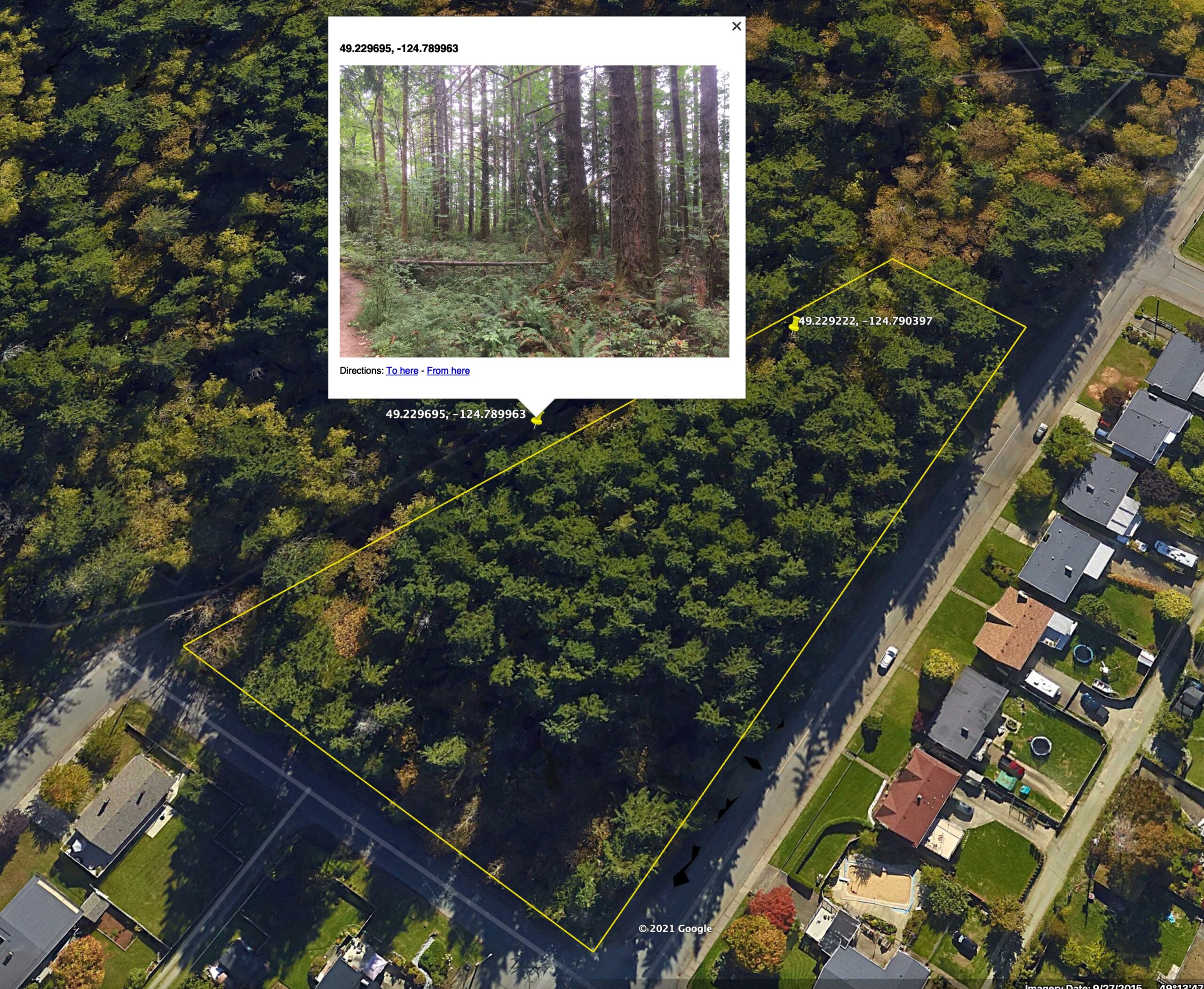
And finally, a picture of the creek from the south end of the trail at the Maquinna Trail entrance, south of the development area, looking back along the trail and boundary.
Updated Pictures of Creek outlet – July 21
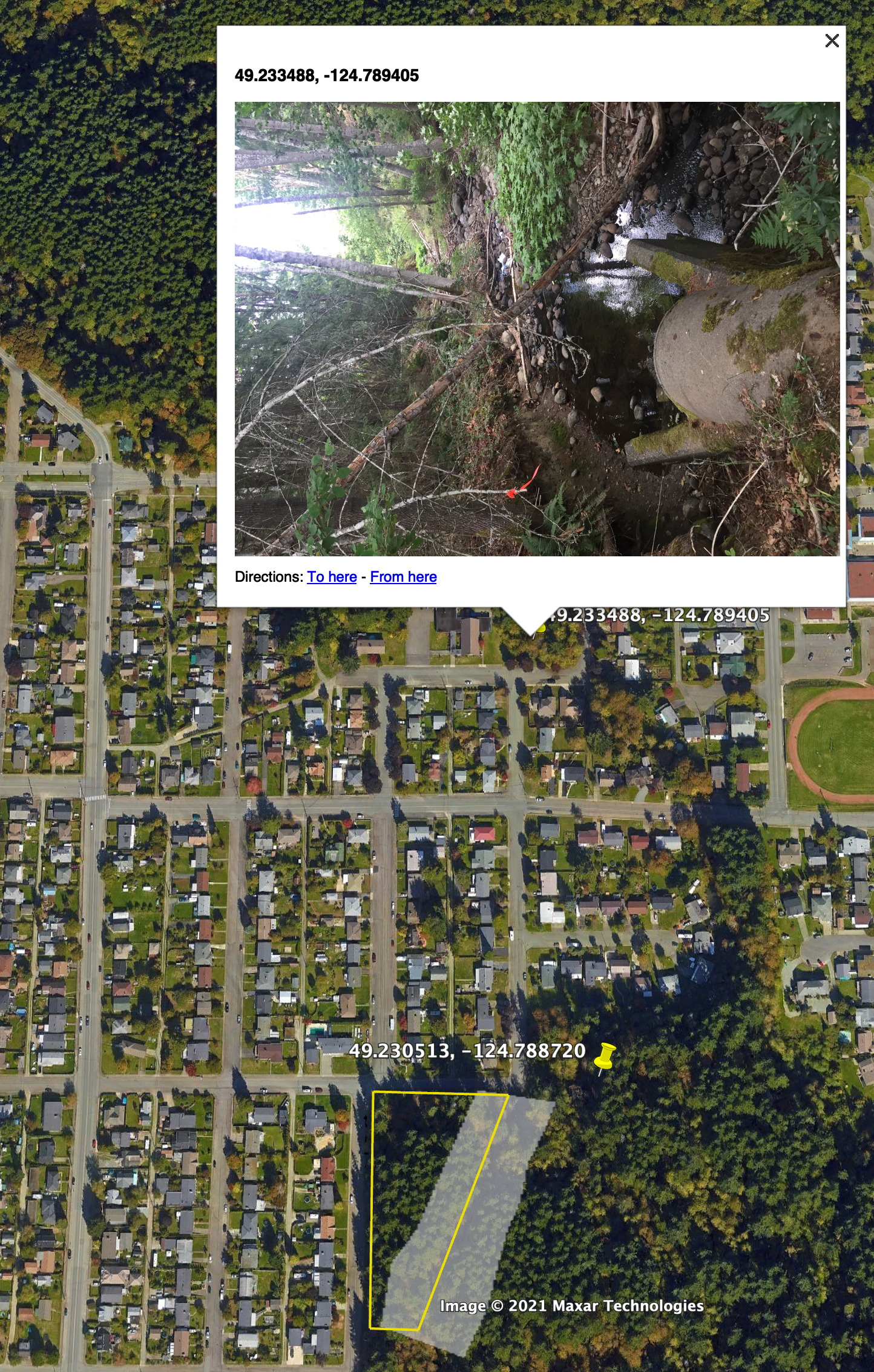
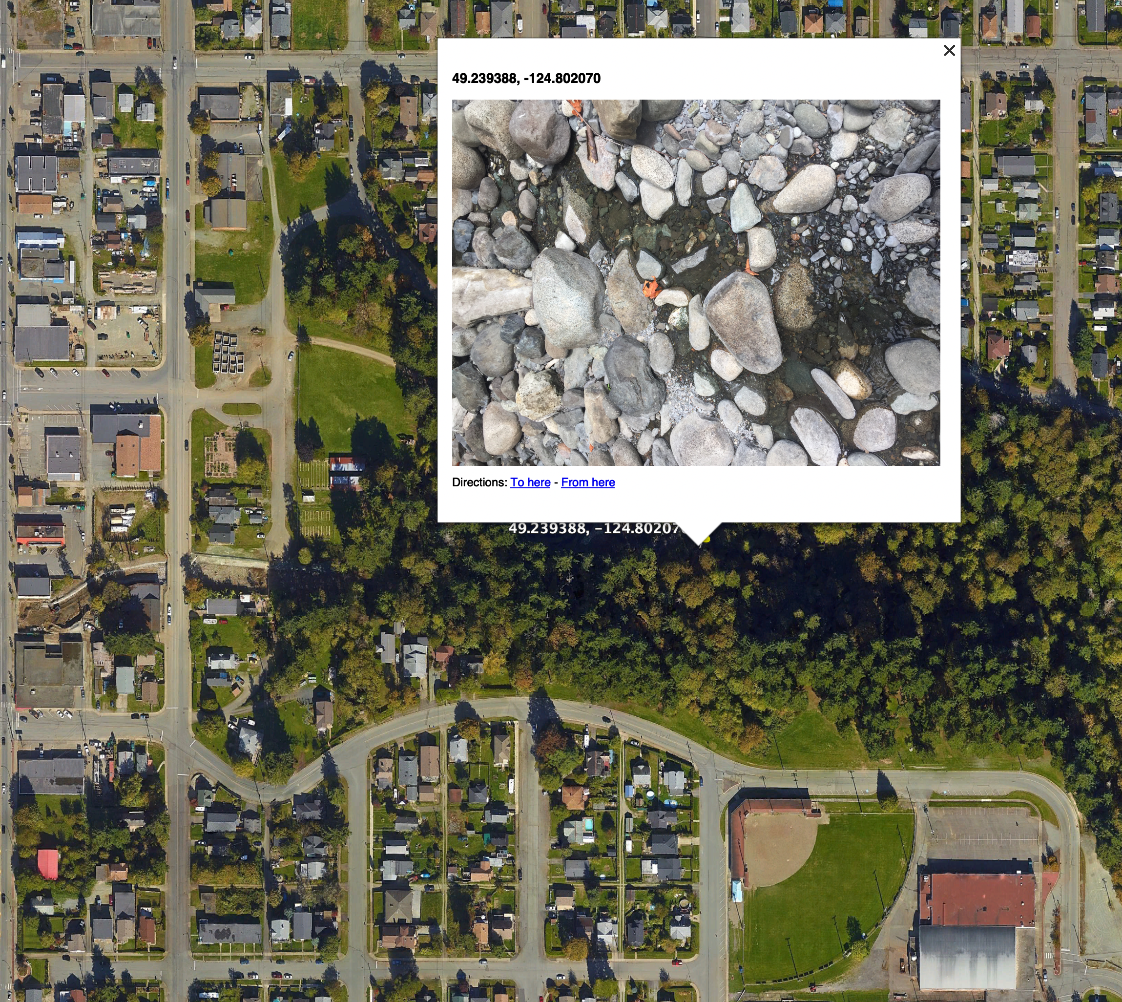
On July 21, I returned to Montrose and 16th to investigate what was in the area surrounding the north end of the creek and to confirm what happened to the creek once it entered the culvert.
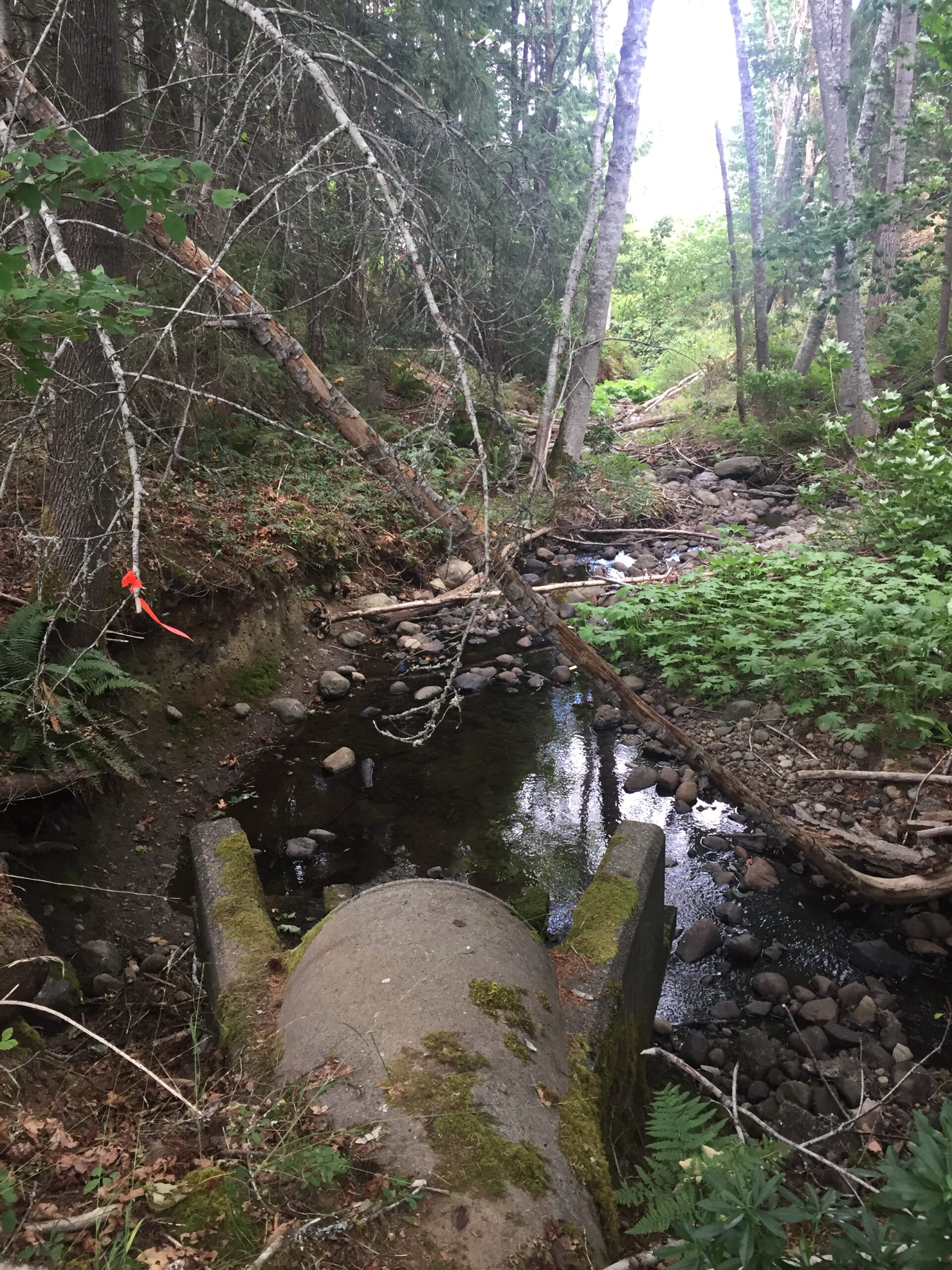
Here is the culvert at the north end at the corner of 16th and Montrose.

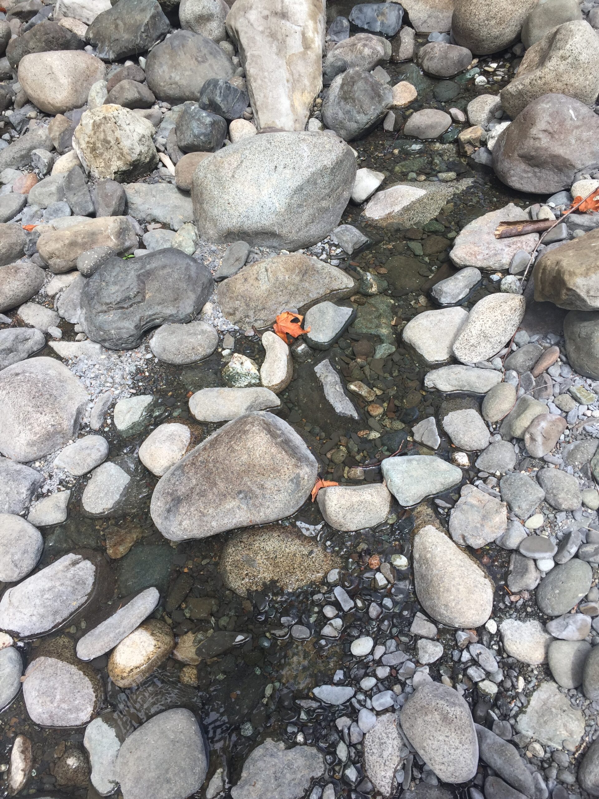
Turning around to look south, here is the creek bed, notice the large debris gate a few foot up from the culvert.
A closer look at the debris gate.
Just on the other side of that debris gate is an outlet of a small stream that runs into the creek.
That stream appears to be connected to a bog/wetland/marsh that is just to the east of the culvert.

If we pull out on the map we can see that this area actually links into the larger stream, which follows the trees and runs into dry creek at Argyle.
However, our Montrose creek runs into the culvert which is marked on the City of Port Alberni storm drain map and runs all the way down 16th street (red arrow below) to the United Church property.
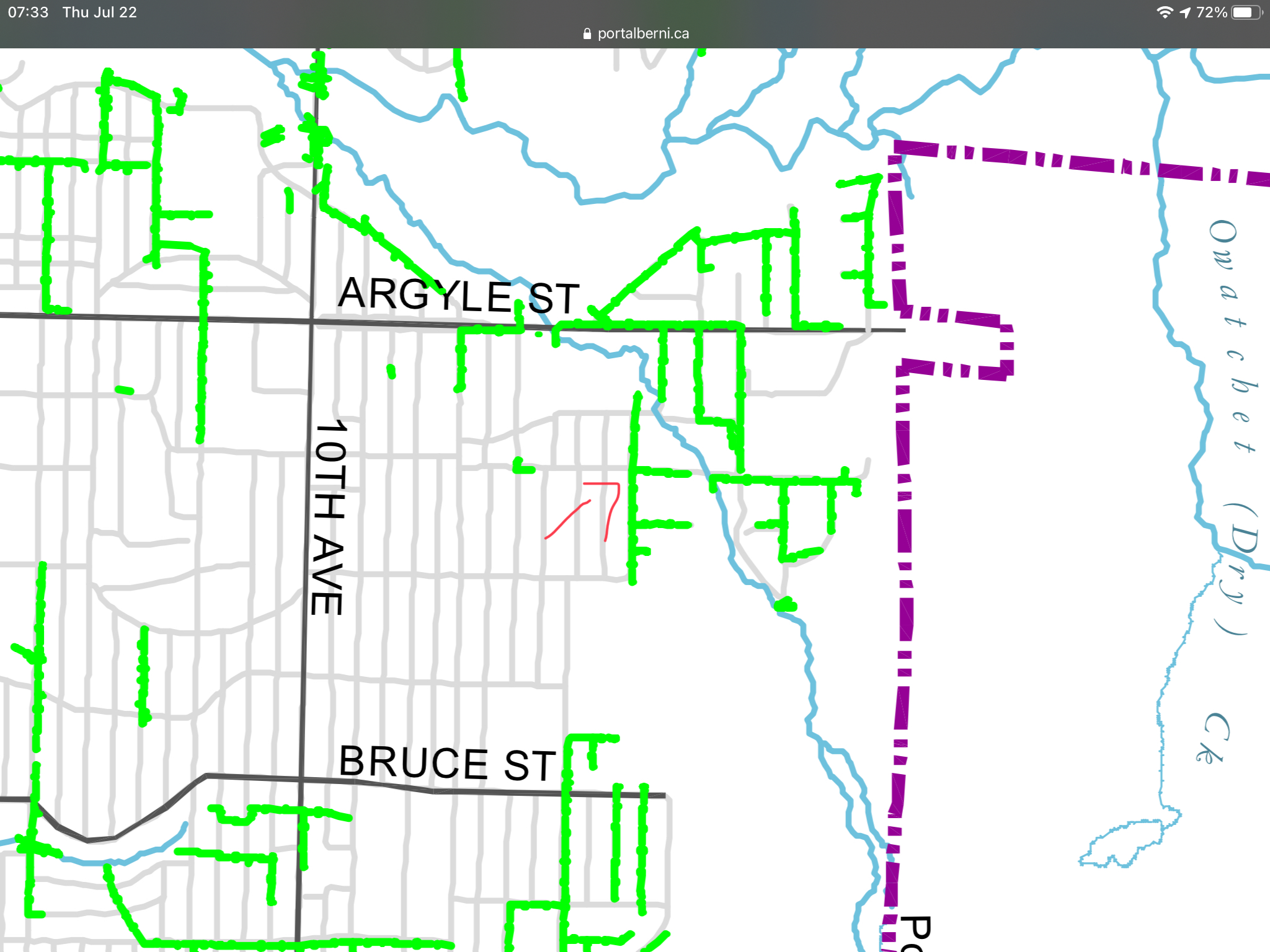
Looking at the city map, it does appear to collect water from three branches before it empties into the larger stream shown below. There was no water exiting the culvert yesterday.
This stream is then culverted under Argyle before it enters Owatchet/Dry Creek ravine.
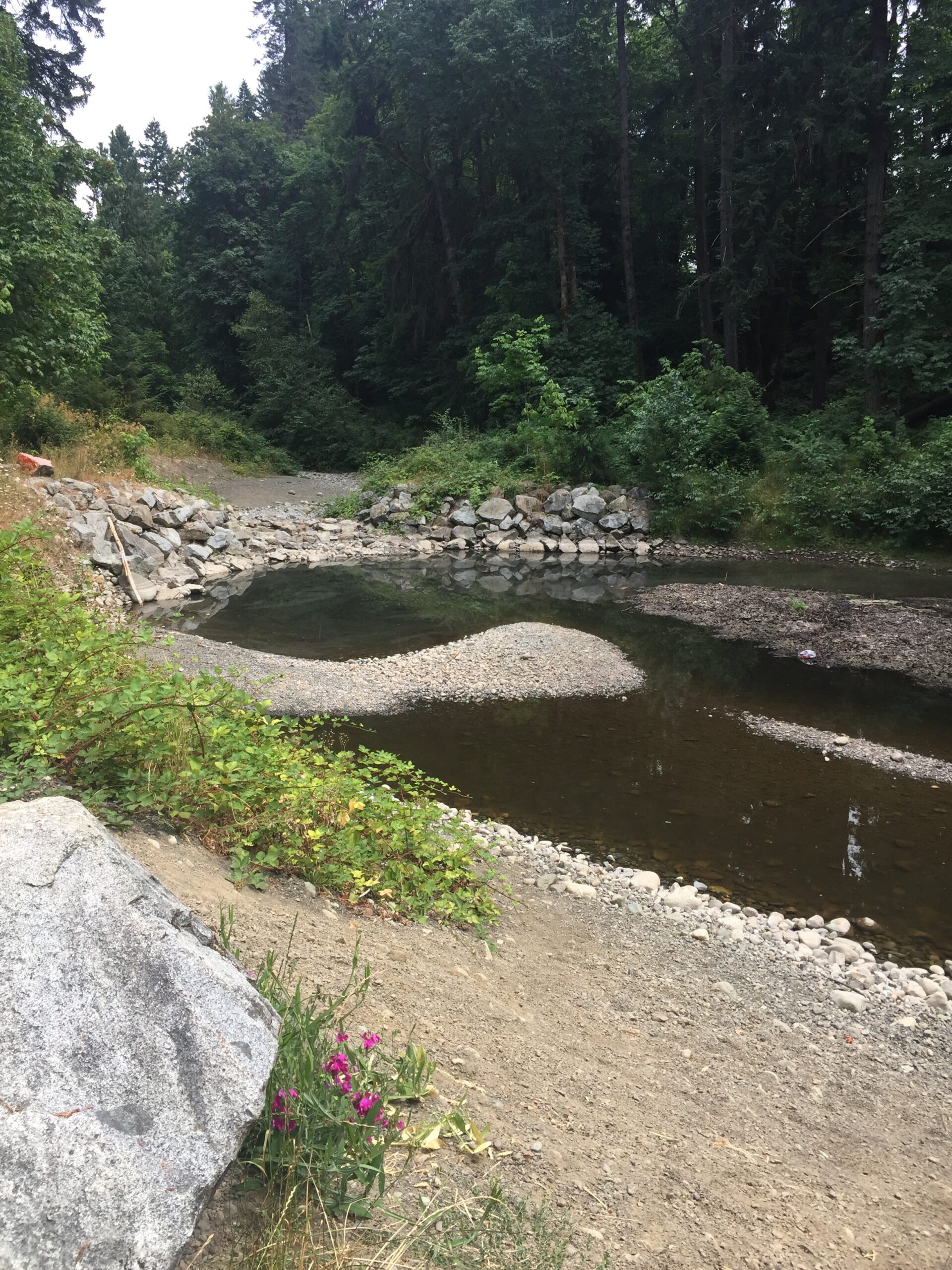
Just for fun, I thought I’d take a walk in Owatchet/Dry Creek and see how “dry” it really was. Note, we are in a historic drought, we have not had rain for over 30 days. So I was actually pleasantly surprised to not only see there was water in the catchment pond, but also water trickling just a few meters upstream.
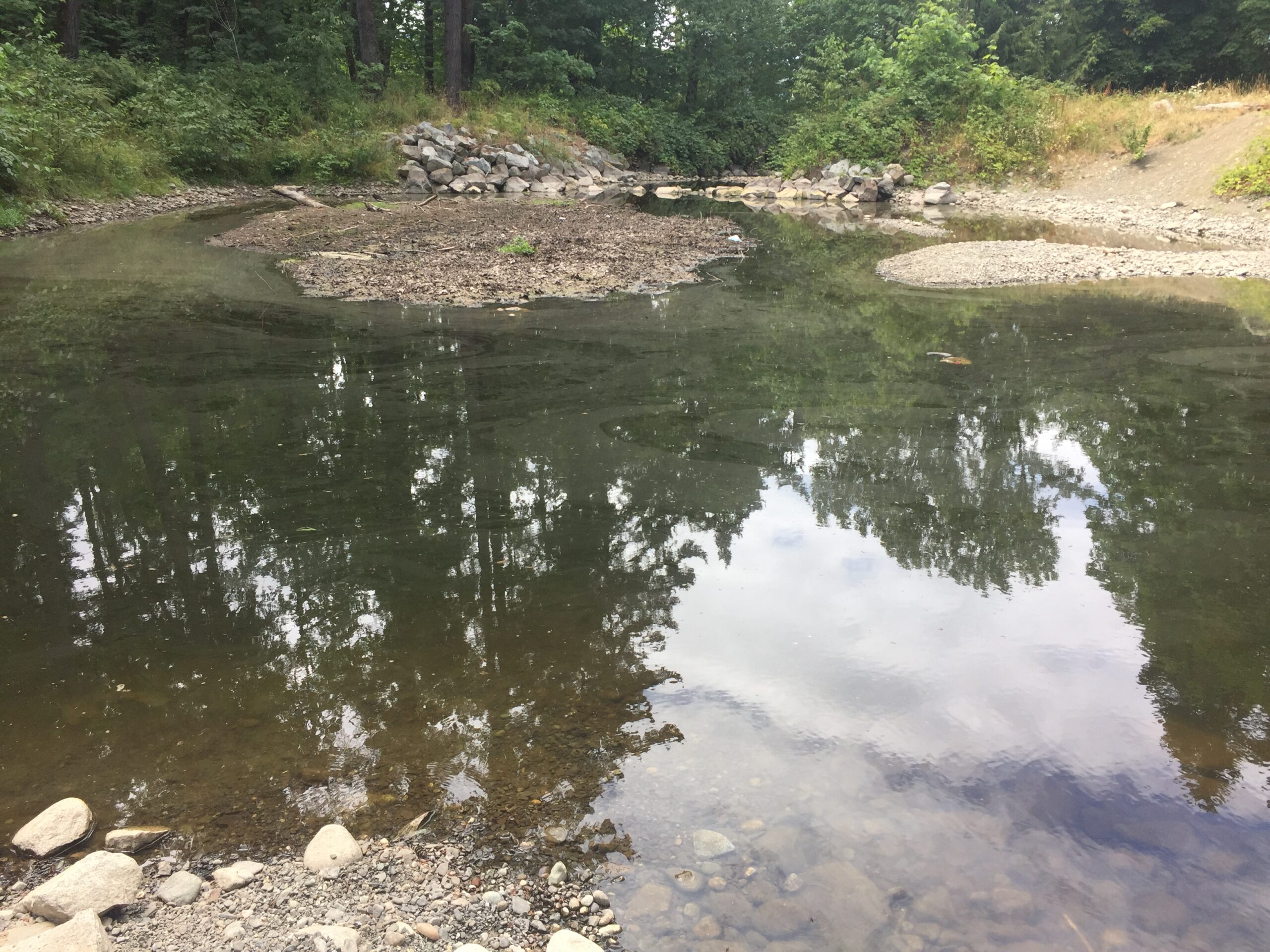
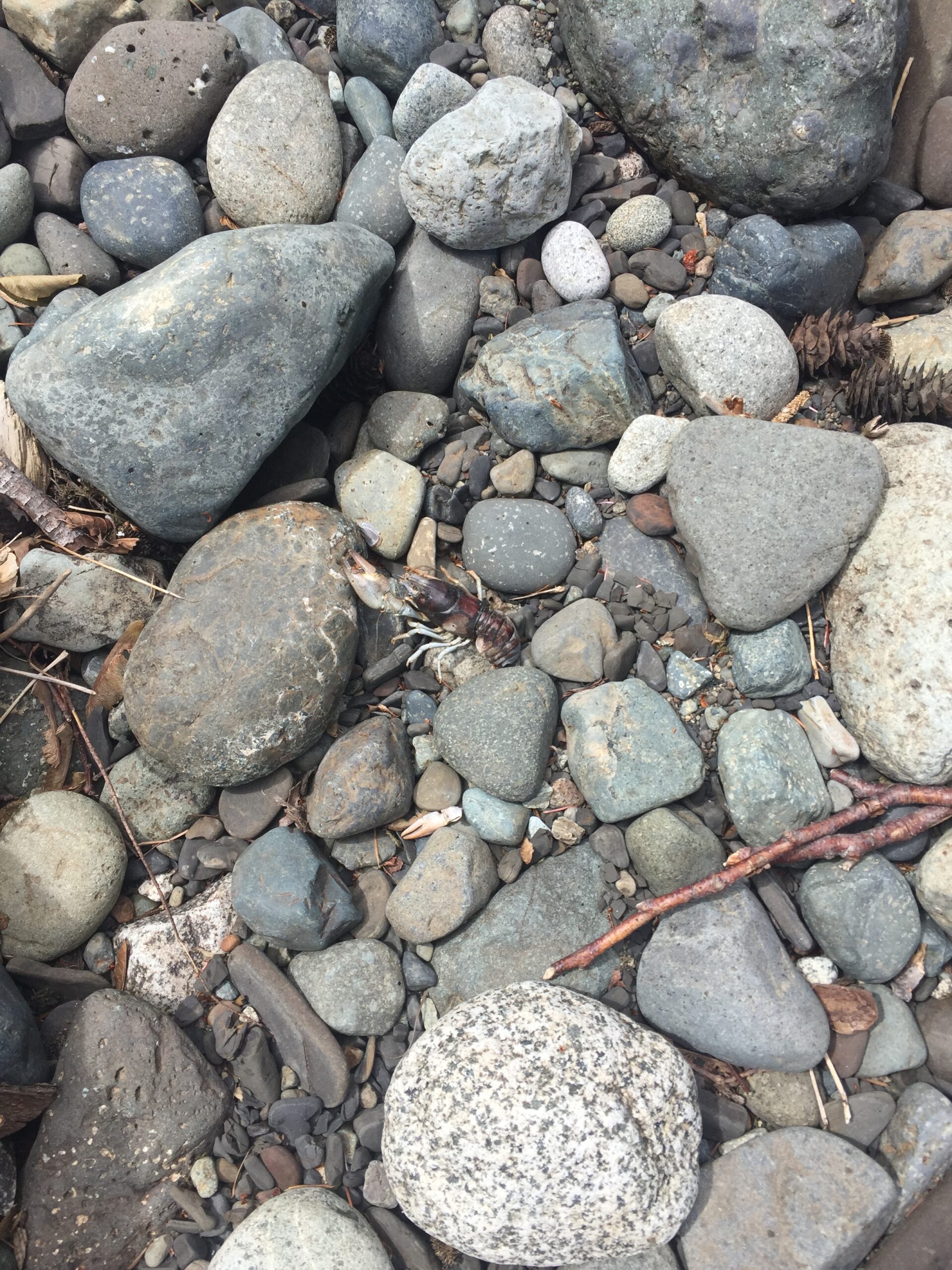
There was a dried up crayfish here too 🙁 Poor little guy.
City Policy on streams and ecosystems.
We have already established that the OCP states watercourses “will be preserved in their natural state”.
The question then becomes, in order to follow this policy, can the City proceed with this sale and development at all?
In the winter months it appears the creek gets up to 2-3 feet deep in places and the small ravine itself is as deep as about 10ft. While this is not a fish bearing creek, it is a major tributary to Dry Creek/Owatchet Creek which is a fish bearing creek. Preserving the vegetation in this tributary means more chance of water being preserved for longer in our increasingly hot and dry summers in Owatchet / Dry Creek.
Policy #6 states: “The City recognizes the value of habitat restoration in the overall health of local ecosystems and supports efforts to undertake restoration projects.”
Habitat protection is the best kind of habitat restoration.
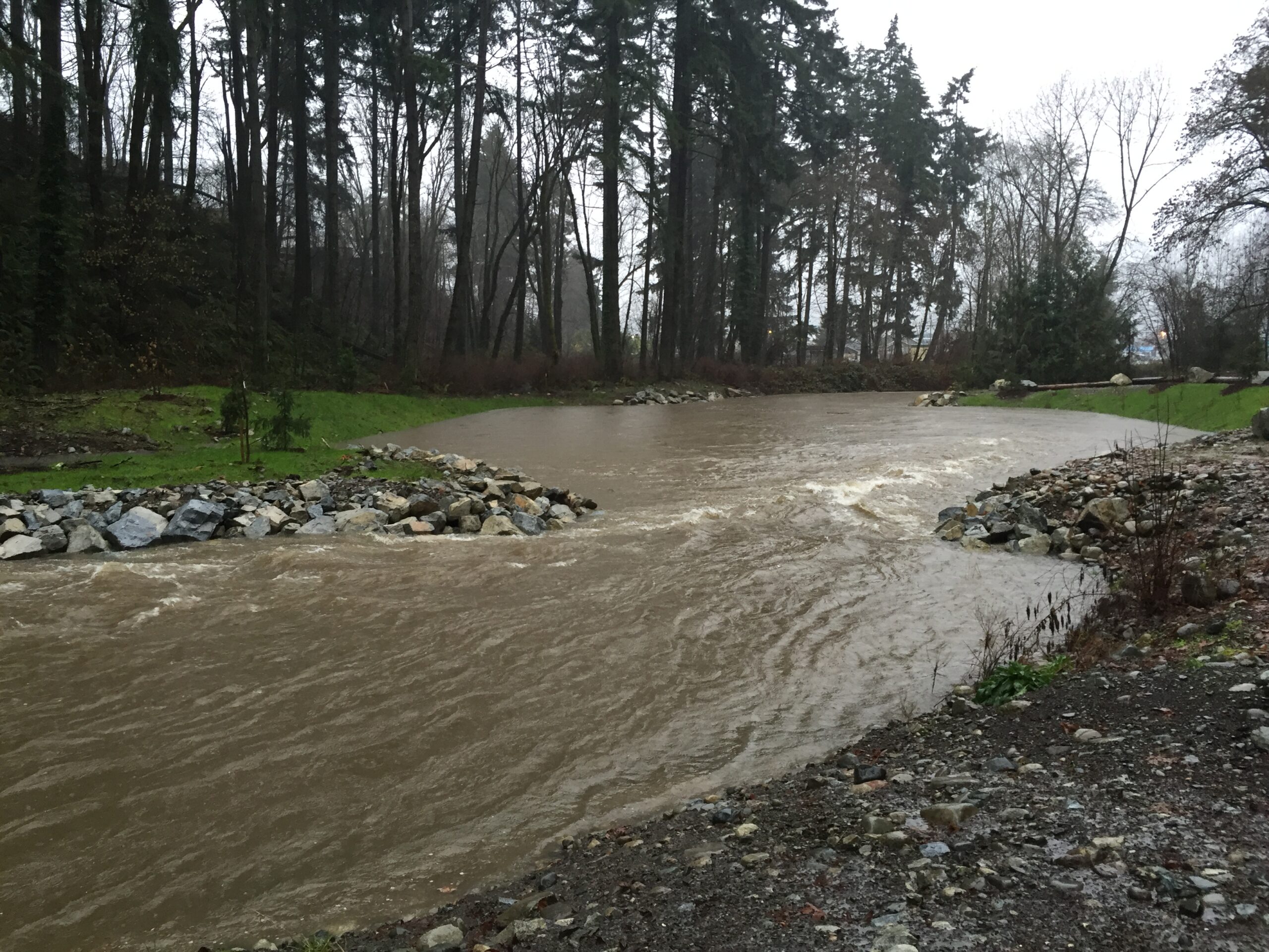
The City of Port Alberni spent millions of dollars doing habitat restoration in Owatchet / Dry Creek itself. You can see pictures of that project here. One of the most significant features was a huge pond created just inside the ravine at Dry Creek park:

It was a huge amount of work… but it was successful! Here is the same spot after completion and during a big rain event! The pond is meant to act as a permanent source of water so that fish can survive through the summer months. In other words, it is an effort to keep water in “Dry” creek!
That brings us to Policy #8 states: “The City will encourage the use of innovative development standards particularly in regard to storm water management.“
This development must be looked at in the greater context of the City’s storm water management policy, especially given the direct impact to homes and businesses on 3rd avenue and 4th avenue.
Specific requirements for watercourses.
The OCP has very specific Policy that the Council is expected to follow when doing development around watercourses.
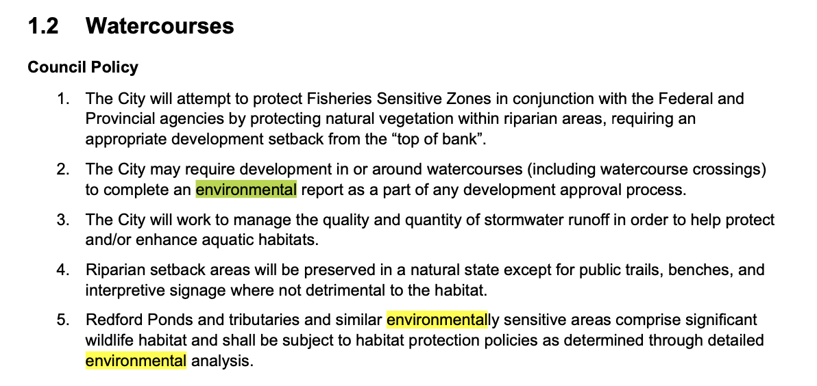
Key points
- “appropriate setback from the “top of bank”.
- “complete an environmental report” as part as the approval process
- managing stormwater runoff to “protect and/or enhance aquatic habitats”
- “riparian setback areas will be preserved in a natural state”
Even though the City of Port Alberni is not covered under the Riparian Regulation, it can be used as a guide.

According to the act, the assessment area is on 30 metres on each side of the stream. So let’s look at what that looks like for our area… a rough estimate of the 30m zone around the stream is shaded in white.
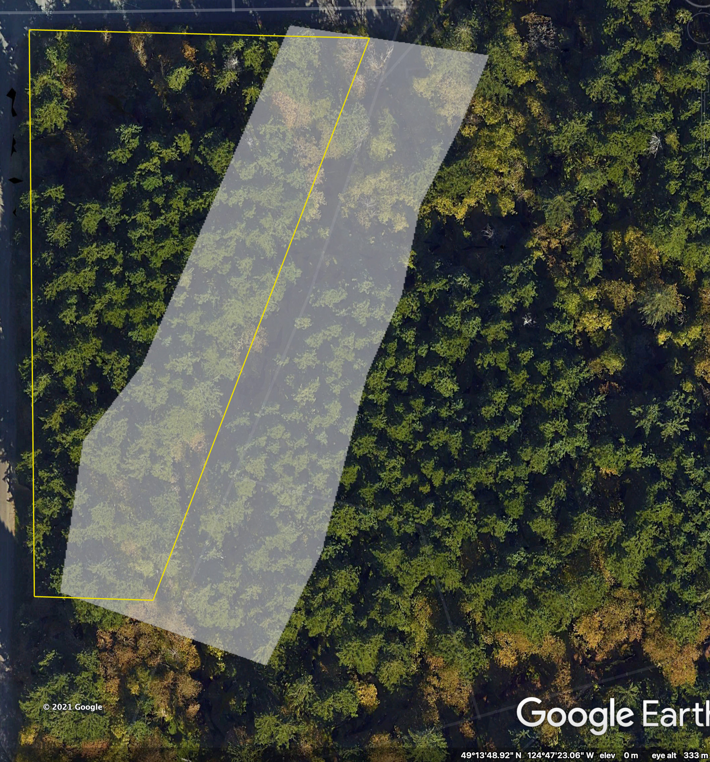
The City should be completing this assessment as part of the Neighbourhood Plan if they are going to pursue development of this parcel.
Will this development cause flooding in Maquinna area, or make 3rd and 4th Avenue flooding worse?
This is a critical piece. It is very likely that in storm events this creek becomes very full and may even spill its banks. It would be important for the City to undertake an environmental review to ensure that any development on this land would not be susceptible to flooding in the event of extreme rain events.
It would also be very important to understand how development here would impact locations downstream. Less vegetation generally means more runoff into local streams and rivers. Development of this property, as small as it might seem, may even lead to a greater chance of flooding in the 3rd and 4th avenue areas.
Especially in the face of climate change this is a very important consideration.
It is worth noting there have been no requirements put in the RFP for “innovative development standards in regard to storm water management”.
Is this an important stream?
Let’s look at the Province of BC “Riparian Areas Protection Regulation Technical Assessment MANUAL” (page 11).
Note: For some reason, the Alberni Clayoquot Regional District and Port Alberni do not appear to be covered under the Riparian Area Protection Regulation. I am not at all clear why. However, it can still be used as a guide:
“A stream may not be currently inhabited by fish, but may provide water, food and nutrients to other streams that do support fish…. In general, the only watercourses excluded from the definition of stream under the RAPR are those that do not support fish or drain into a watercourse that supports fish.“
This stream lies inside of the Dry Creek / Owatchet Creek watershed as delimited by the province. I’ve drawn in the approximate course of the stream in both the BC provided map and Google map below:
UPDATE: I think the course drawn below might have been the “original” course of the stream before the city was built up. There is a bog/wetland just a few metres from the end of the stream/culvert. The lay of the land is complex here so some areas probably drained toward the stream to the east, and others probably followed the path where the culvert is now along 16th avenue.


As I’ve already noted, storm water management will be key. Will changes in the forest cover of this stream impact residents in the China Creek Road and Argyle area as well as further downstream at 4th and 3rd Avenues?
Legal Jeopardy of the City of Port Alberni not being covered under the Riparian Regulation
The BC Government website for the Riparian Regulation includes a 2005 legal opinion “A legal opinion was jointly commissioned by the Ministry and the Union of British Columbia Municipalities (UBCM) to address Resolution B75 passed at the 2004 UBCM annual convention. The resolution requested a legal review of local government liability from the Riparian Areas Regulation.”
I will not go into the nitty gritty of this policy discussion, but suffice to say it is up for debate whether the City of Port Alberni or developers would be liable if a development was approved that subsequently endangered or damaged fish bearing streams covered under the Department of Fisheries and Oceans.
However, not following ones own bylaws could present a liability problem. One section of the 2005 legal opinion states:
Liability is a question worth asking.
At the very least, an environmental assessment should be done by the City *before* any RFPs are issued and development is pursued or approved.
Cost to Taxpayers
A common point people often make is that the homes built on this site would generate tax revenue that would lower the taxes of all residents in Port Alberni.
The small size of this area would only allow for 10-15 single family homes which would generate on average about $2000-$4000 each representing $20,000-$60,000 in tax revenue per year.
This is similar to the cost of one environmental report.
However, the cost of servicing the new lots with sewer and water, and the maintenance of infrastructure over time plus the potential cost of increased flooding due to storm water runoff could far outstrip the $60,000 a year this development might represent in added revenue.
The best way to increase revenue for city tax coffers, and to decrease costs… is to improve storm water management and reduce runoff by increasing, not decreasing green and natural spaces and by redeveloping primarily single family housing into larger density housing that can have a mix of market and affordable rate using the infrastructure we already have.
Reach out to the City
Again, I hope this post has been helpful, if a little scattered. If you have any comments, you are welcome to leave them here. My email and phone number are also at the bottom of this page.
Take care, and protect the wonderful things in our City.
You must be logged in to post a comment.