City Owned land on the market.
At an Alberni Valley Transition Town Meeting on March 17th (agenda here) Councillor Poon, who is the City representative at the AVTTS (non-voting) told the members present that the City has tasked the newly re-hired Director of Development with “selling off empty pieces of land that are within our community” and “starting to sell off pieces of land that can go toward infill”.
You can see her comments as well as the whole meeting, (half of which was dedicated to talking about setting up a local group to champion reducing plastic waste in Port Alberni! Which is awesome!).
Below I will go through each part of the City to see what forested areas might be developed.
Councillor Poon wasn’t any more specific than that but today I saw an excellent blog by our community Naturalist (my title for him because he’s awesome!) Sandy McRuer about the potential for development of land around the Beaver Ponds.
This post combined with the statements by Councillor Poon made me think about all of the Future Development zoned land around the City and what the City might look to sell and develop into residential neighbourhoods.
The West side up for sale again?
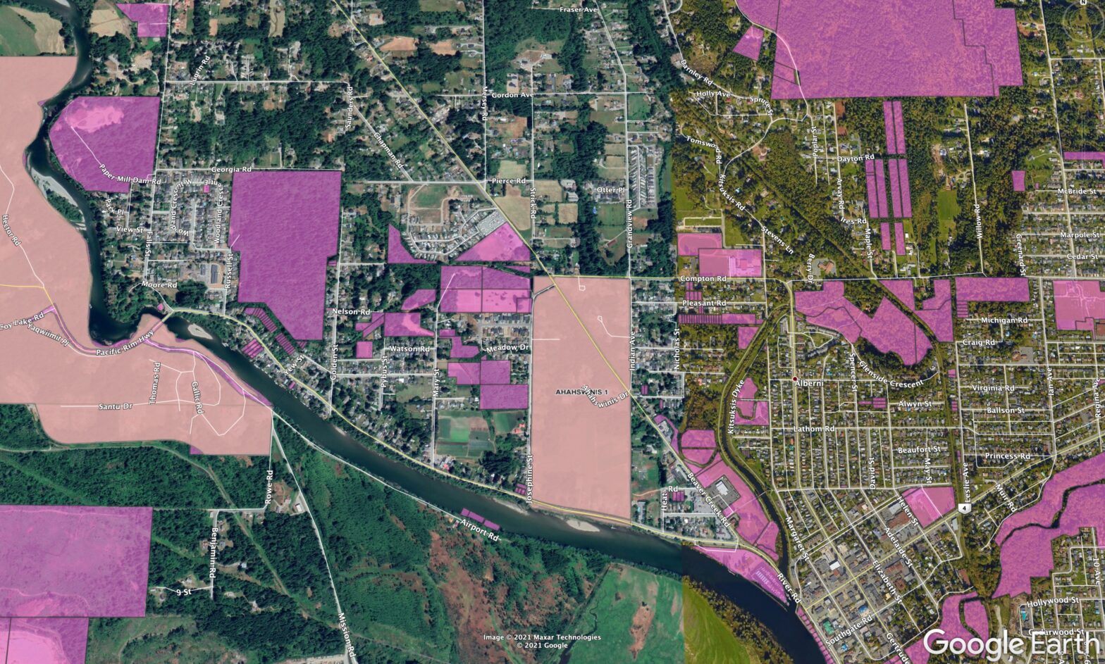
There’s a lot of municipal owned land on the West side, most importantly, the Westporte Forest. Below is a google map showing crown owned lands (and FN reserves).

Now we can look at the Port Alberni Zoning Map which shows the City borders and, most importantly the areas marked “FD” (grey diagonal line fill) for “Future Development”.
The one that stands out of course is the forest space near Westporte subdivision. It has been considered for development as recently as 2016. (Youtube video here)

It is the largest single property that I know of that is owned by the City and zoned Future Development (27 hectares/67 acres). There is also an area along Josephine. I’ve marked both with arrows below.
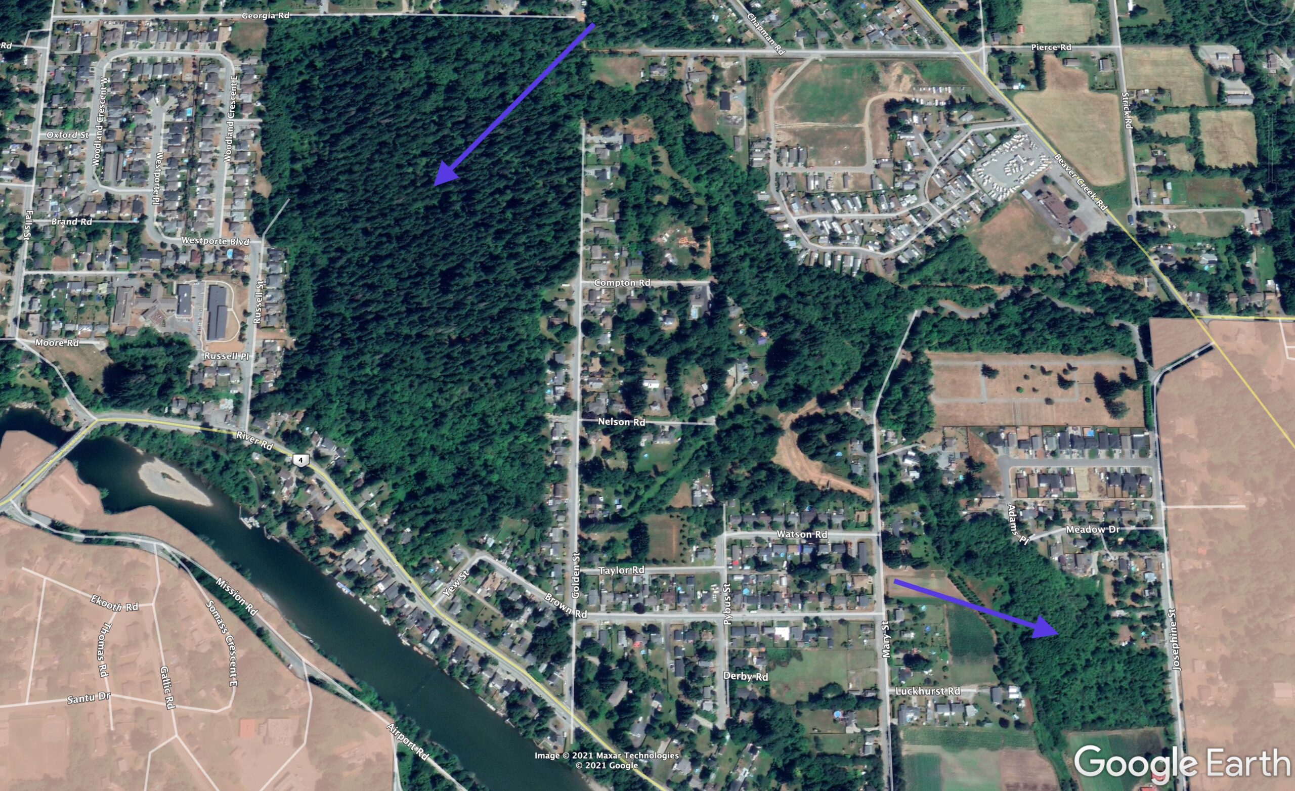
Both are relatively undisturbed land. According to FrontCounter data, parts of the Josephine forest is owned by both the province and the city. There are also some city owned undeveloped lands currently designated as parks or as RR2 (Rural Residential) between Josephine and Westporte around the Golden, Watson and Mary St areas.
North Port Areas
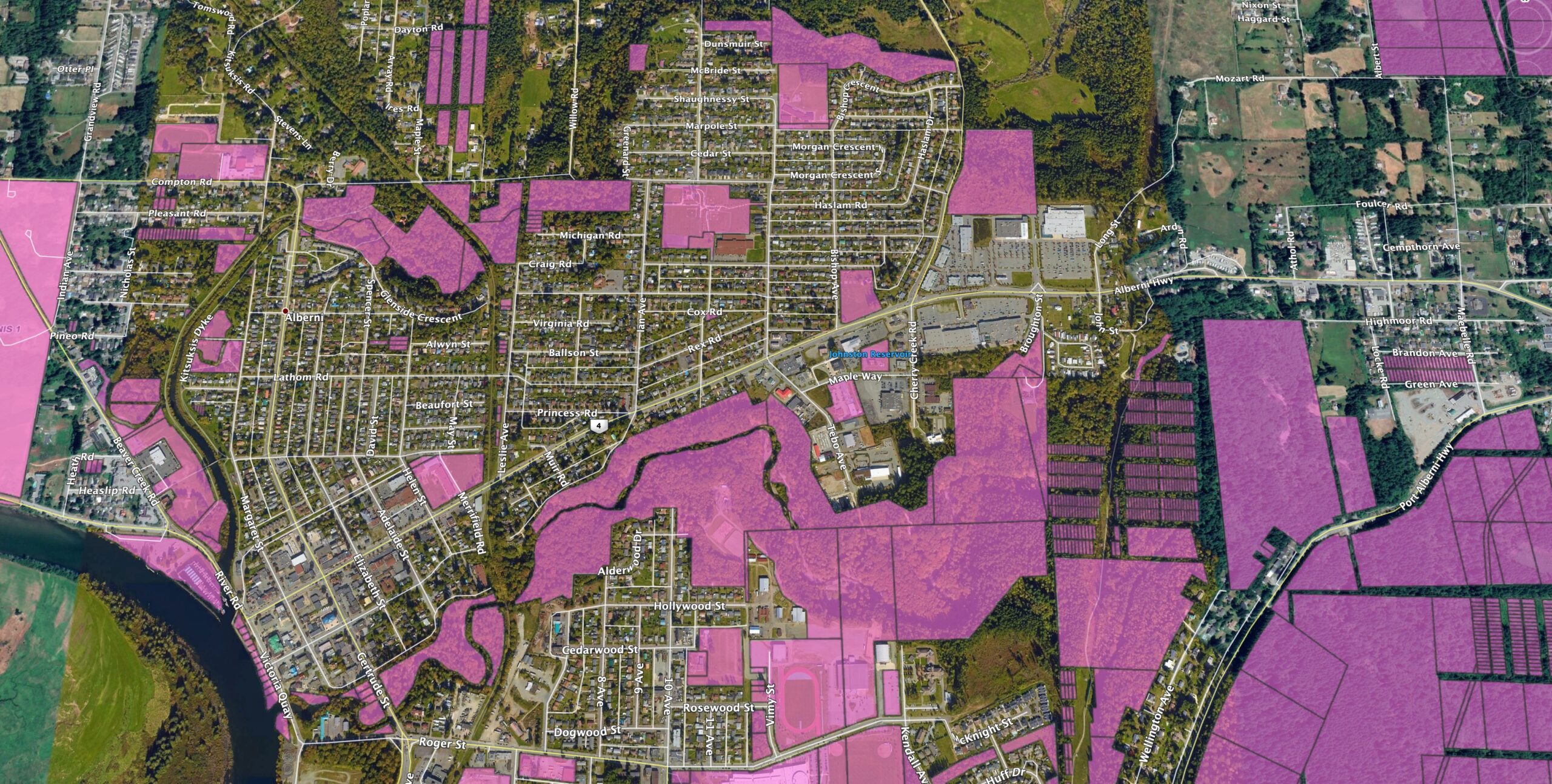
Within the more business focused areas of the City, there are less lands that could be easily sold off for development. So we have to look at the outskirts to see possibilities. Reminder: Not everything in purple is owned by the City, some will be provincial, school district, and federal property.
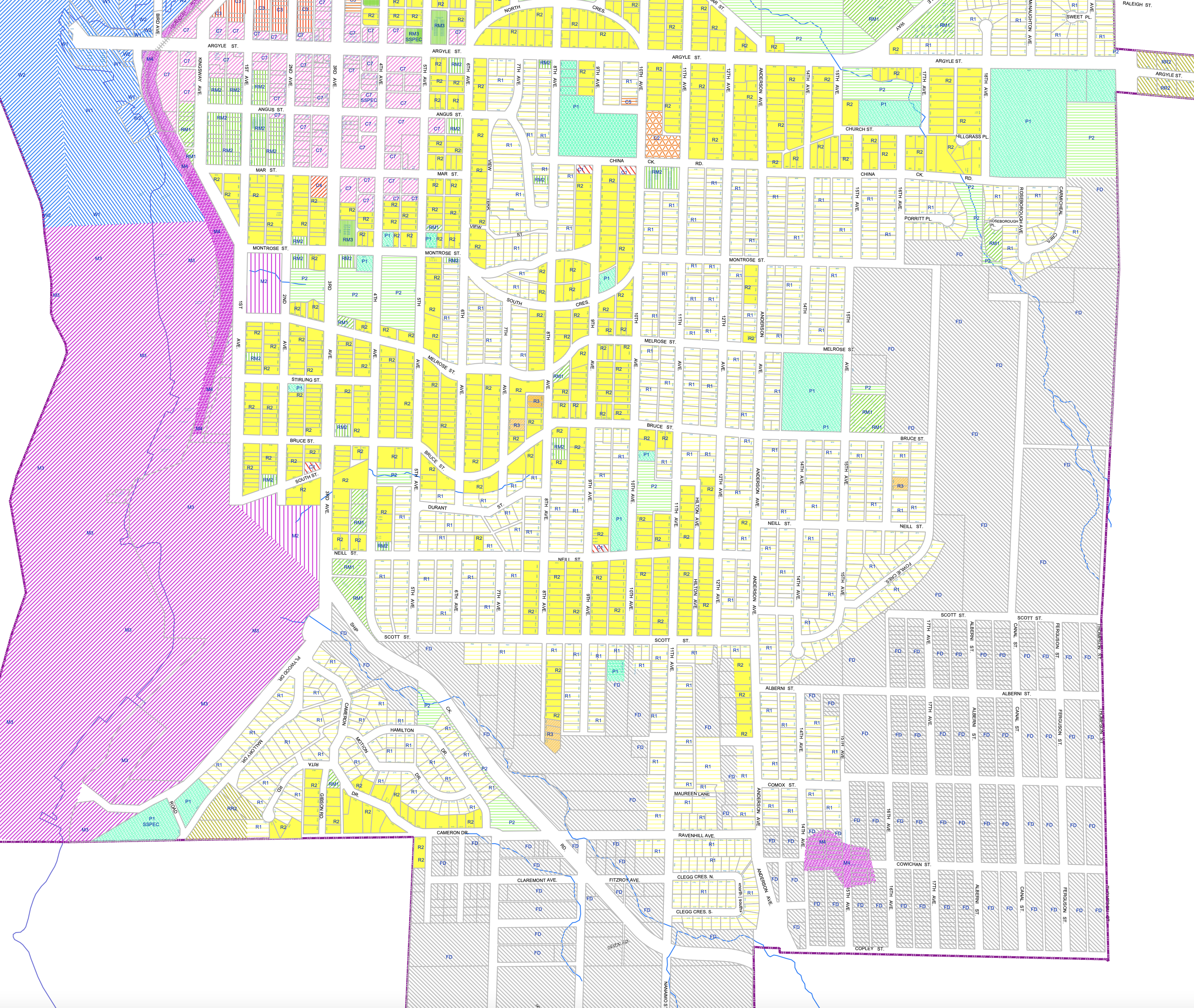
Here is the zoning map from the same area.
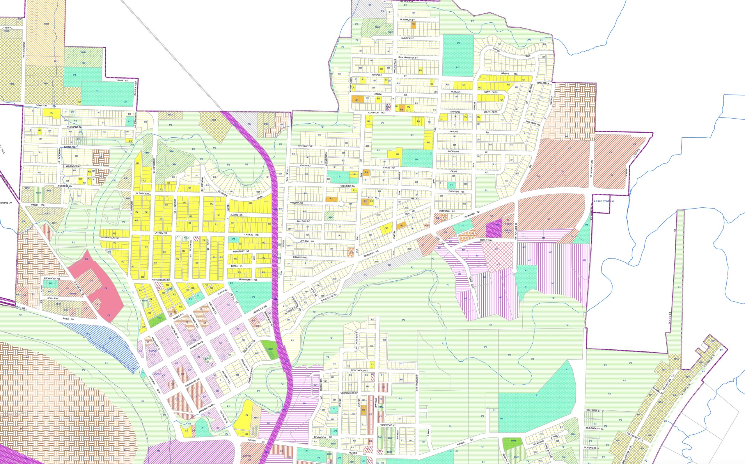
The ones that pop out for me here are along the edges of the City boundary and along Roger Creek.
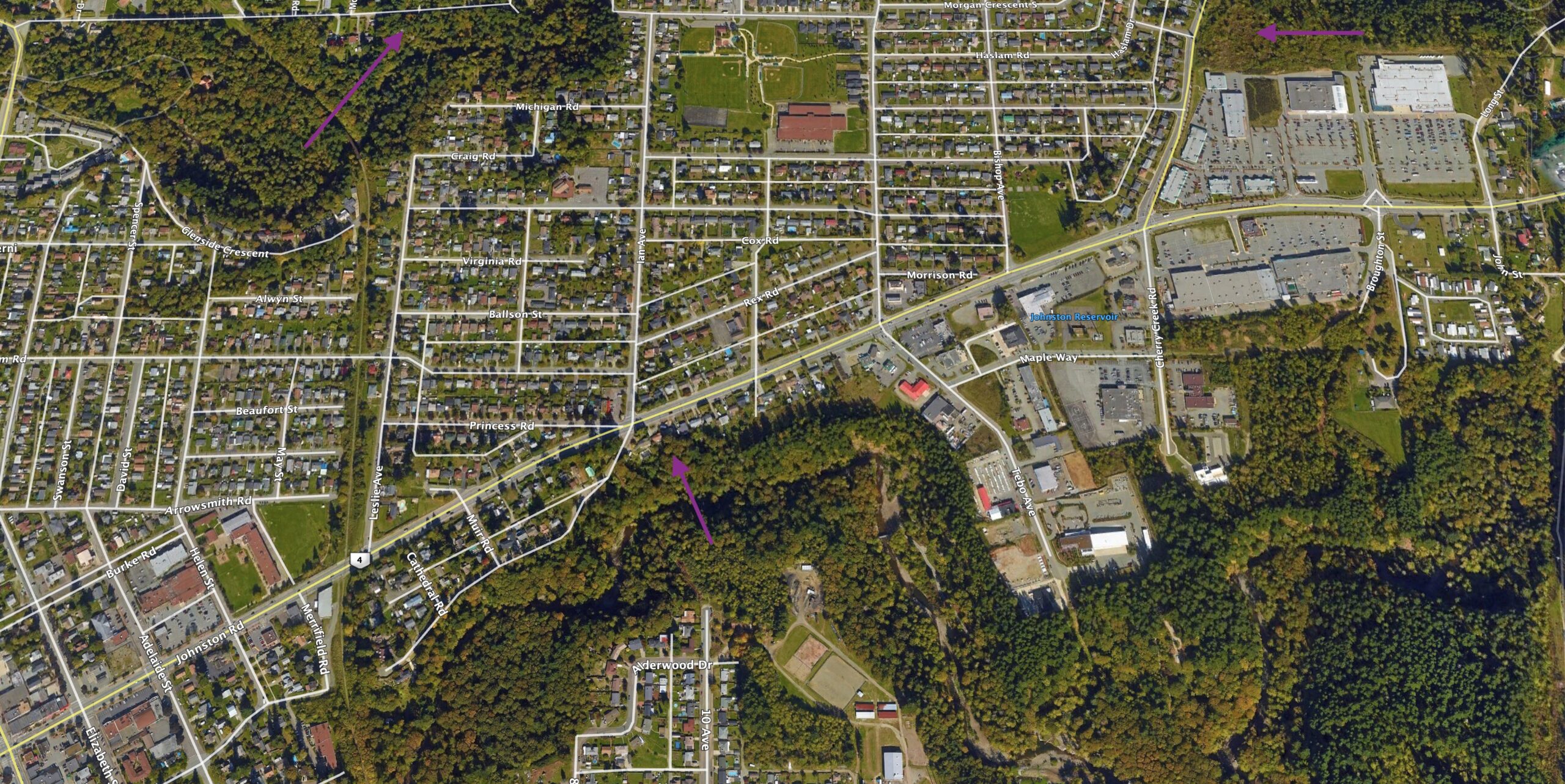
Properties along Compton, the large and often talked about agricultural land (currently forest) on Cherry Creek Road behind Staples, the small strip of land near Southgate along Roger Creek.
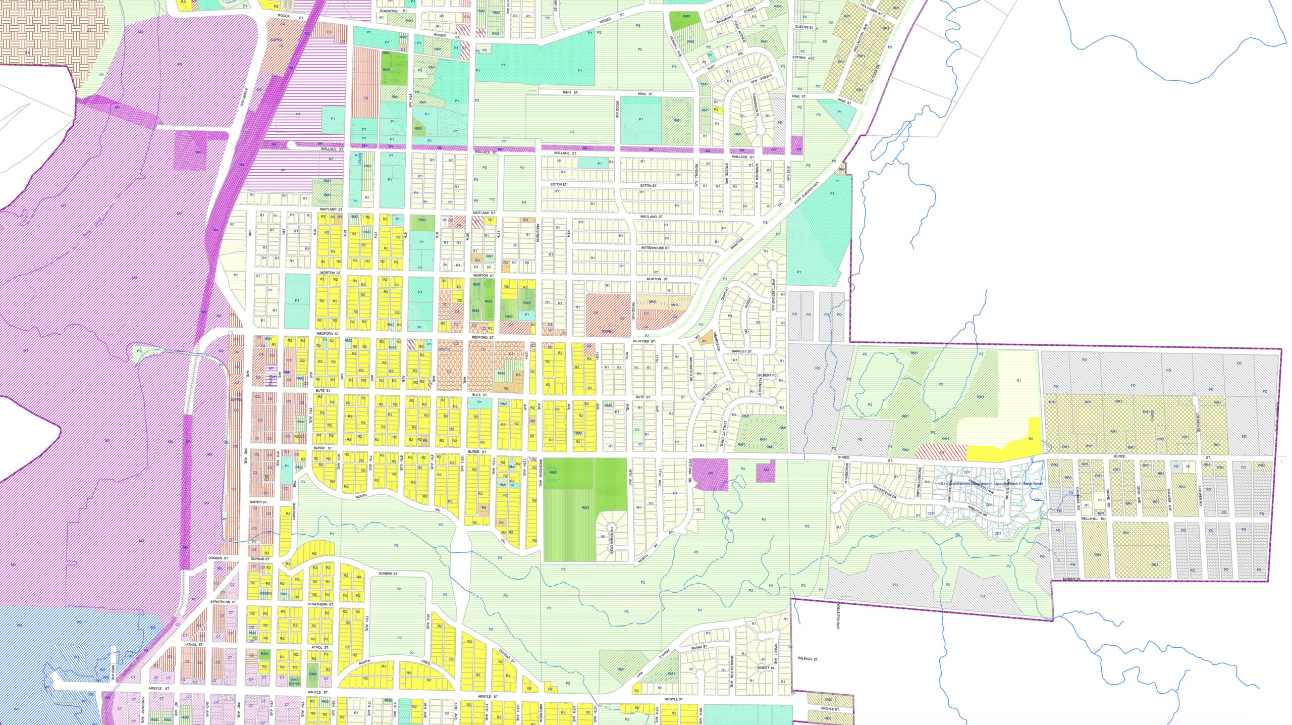
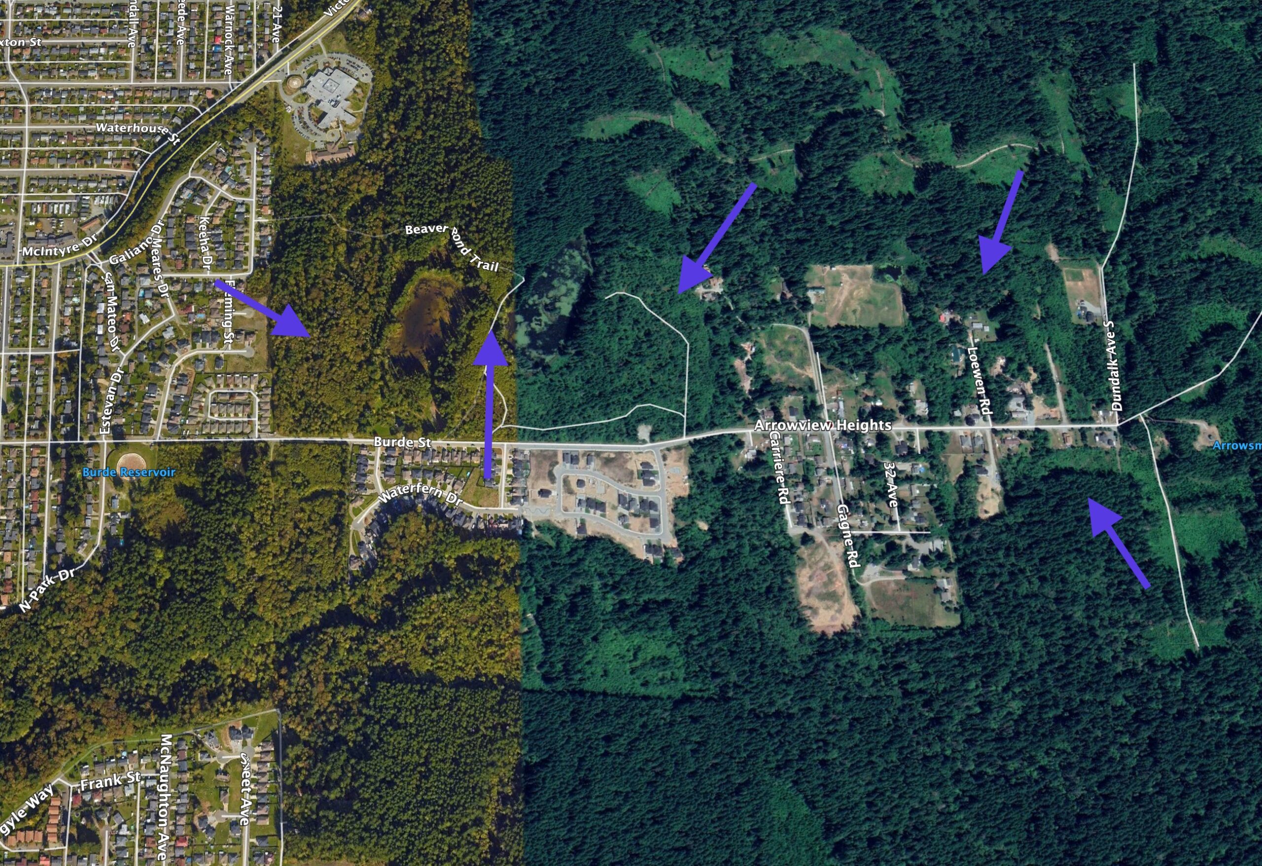
Central Port, Beaver Ponds, Log Train Trail, Burde
If we look at Central Port Alberni from Roger Street to Argyle, a lot more lands come up. Check out Sandy McRuer’s wonderful blog post which includes pictures of this pristine area for more about that area specifically.
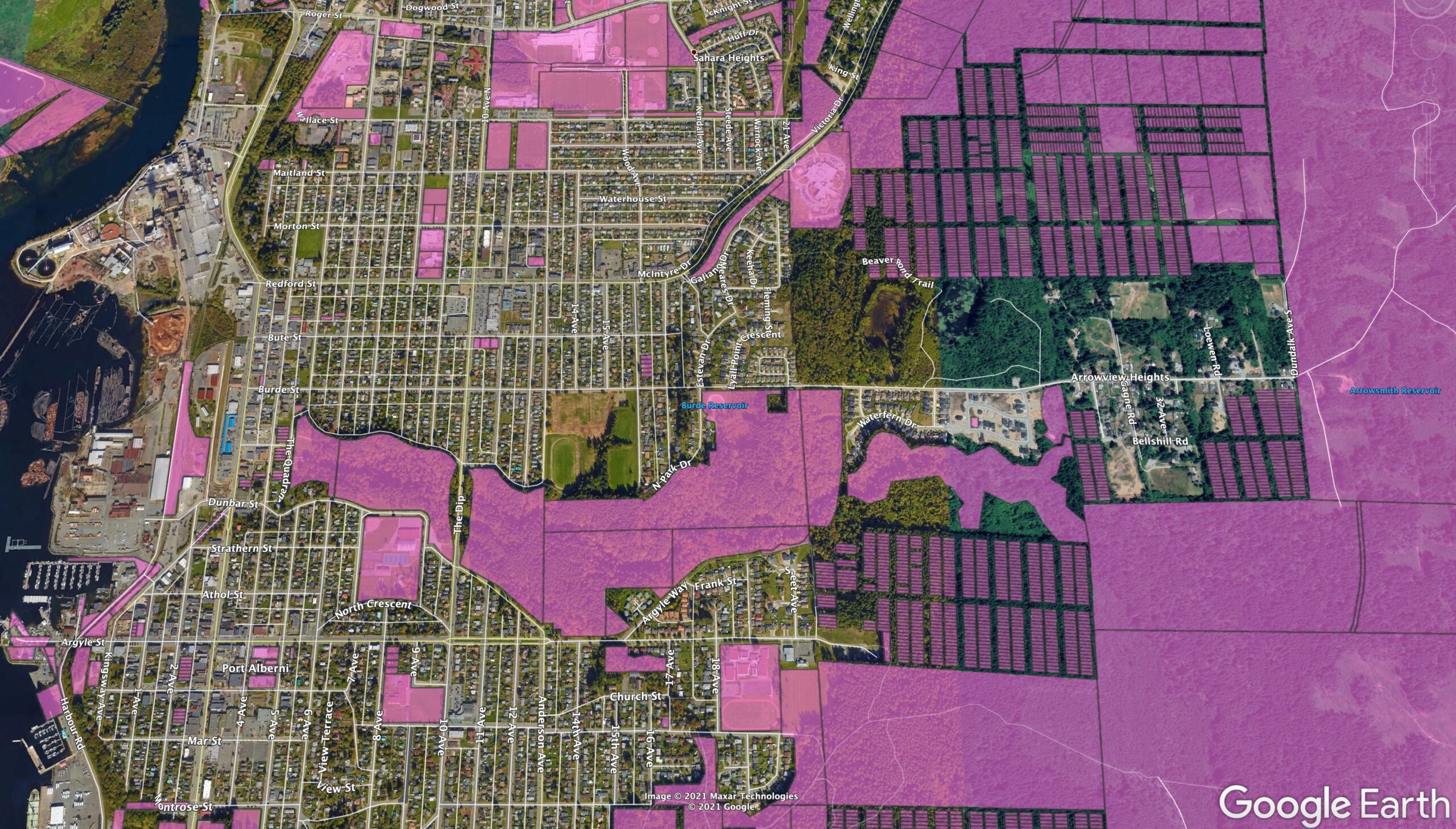
You can see on the zoning map there is a ton of “Future Development” zoned area at the top of Burde Street, around the Beaver Ponds, the Log Train Trail and at the eastern extremity of Burde Street.
There is also a large (in pale yellow) area marked R1 residential beside the Beaver Pond that could easily be developed by the private land owner. I’ve pointed out all these areas below. Most of these areas are currently forested.
South Port – Maquinna and Ship Creek
Finally, South Port.
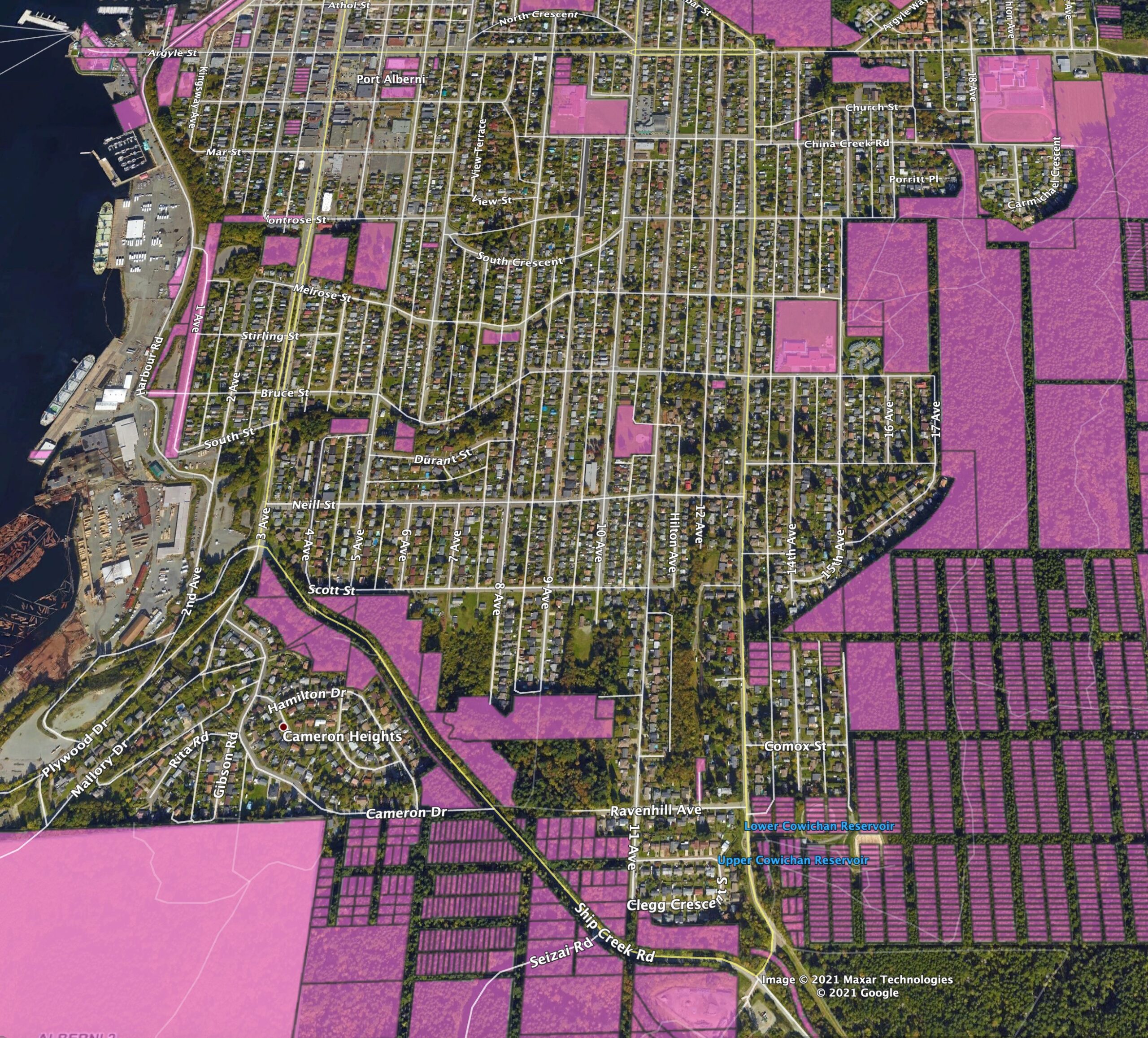
This is the largest concentration of Future Development zoned land in the City and it is also the part with the largest amount of municipally owned land.
The land on the east side of Maquinna and 17th Avenue is all Municipally owned. However, I am not sure if this is owned by the City or if it is actually controlled by Hupacasath.

If it is owned by the City the two largest parcels near Maquinna and behind Fowler Crescent are around 18 hectares (44 acres) together.
You’ll also see a significant number of properties marked Future Development along Ship Creek Road, especially near Ravenhill and Clegg.
If you total up all of the Future Development zoned land between Montrose and Ship Creek (highlighted in white below) you come to about 100 hectares (247 acres) of currently forested land.

Here are those areas again pointed out with the arrows.
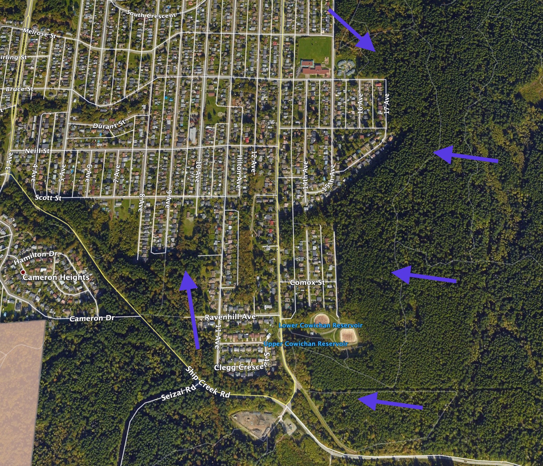
An absolutely massive amount of land.
Is the City going to develop all of this land? No.
There is no way the City would be able to sell all of this land at once. Even in today’s very hot real estate market there would need to be huge developers lined up to take on this much land and there is simply no way there would be enough demand for the resulting homes or commercial development. It will take years and likely decades.
However, without hearing more from the City on its specific ideas and goals in terms of developing its considerable land marked as “Future Development”, this post should hopefully give you an idea of what the City has available to it so you can decide what kind of development, if any, you would like to see. Hopefully the City will take an open approach including neighbourhood planning.
Doesn’t make sense to develop green space.
I don’t see much need to develop any of this land. Within the City, our groves, forests, green spaces and parks continue to shrink. This contributes to a less desirable City economically and socially, and a less resilient City in the face of climate change. The most environmentally responsible and best city building approach is to encourage a more dense, vibrant, and walkable City core, rather than spread it into the margins, forcing people to travel long distances just to get to work or the grocery store and forcing Cities to spend exorbitant amounts of money building and maintaining roads, sewers and other amenities.
If we really want urban sprawl, there are plenty of underdeveloped areas in the already residential parts of Cherry Creek, Beaver Creek and Sproat Lake. But obviously those start to present the same problems as would the City. Of course, the disadvantage for the City is those areas are not in City limits, so out of the control, and taxing authority, of the City.
One of the reasons I believe the whole Alberni Valley should be one City is exactly because of this kind of thing. We should be looking at our Valley as a whole to decide how best to use and develop, or not develop, land rather than this piece-meal approach. The ACRD has also contributed to urban sprawl and destruction of habitat by creating new subdivisions, residential and agriculture development in Cherry Creek, Beaver Creek and Sproat Lake.
Then we can have real discussion as a community about what we want to protect for all of us, and what we feel we can develop. I hope you find this post useful.
Also, here’s the Legend for the zoning maps. Thanks for reading! :+)

Thanks Chris. Great set of maps–interesting to see the skeletons of the old subdivision plans. But what is the status of the roads associated with them? The lots seem to have reverted to the government, but who owns the road allowances?
I believe you can infer from the Front Counter purple imagery that the road allowances are there and dedicated in both the provincial registry and the city zoning. However, since it would all need to be rezoned to be developed, the potential developer could work with the city to reorganize what those all look like as has been done on Burde.
Hi Chris, thanks for the plug for my blog. BTW there is only on “c” in my last name.
When you advocate for one city, you stand to alienate 5000 residents in the valley. It you call it a Municipality there is less chance. If you call it a unified political entity, they’ll just wonder what the heck you’re saying.
What are you pointing at in the 6th illustration?
I agree that a lot of the property along the eastern boarder holds great potential for the future. But before you can talk about in an informed way, the status of this land needs to be confirmed. A lot of this land contains highly valuable timber that is around 75 years old. old enough to consider reserving some of it as future old growth forest.
Hi Sandy!
Gak, sorry for the typo. Fixed!
In the 6th pic (North Port) I’m pointing at the Municipally owned land alongside Compton, Roger Creek near Southgate, and the piece of land behind the Post Office/Staples.
I completely agree that much of the land in question is very valuable as the forested land that it is and that should be a big consideration, and brake, on any development proposed if climate change and other sustainability goals are taken seriously.
As to my comments around the City, I try not to beat around the bush… prefer to save it. 😉 So I use the City term, which I know gets people’s hackles up but it also at least lets them know the reality. I hope one day we can come together as one community, I really do think it would heal many of the rifts that still separate us and would allow for a much more democratic and cohesive Valley. Everyone would have a voice 100% of the time. But that’s just me, and it’s a little tangential to this immediate issue. 🙂
Thanks for the comment Sandy!